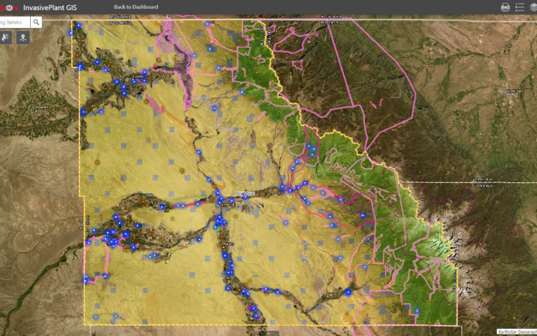
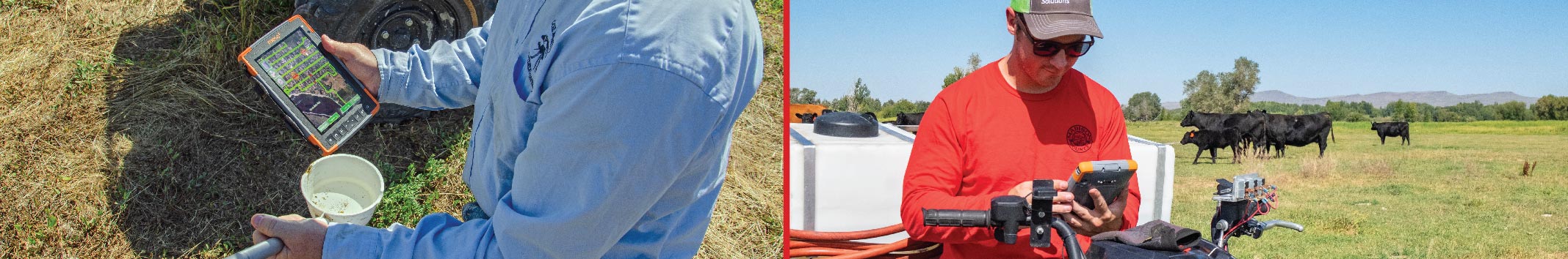
FieldSeeker GIS for Invasive Plant Control software is designed to be the hub of all your important operational data. Built on Esri® ArcGIS® Online, it’s a cloud-based system that provides users with simple, intuitive tools for mapping and reporting data related to invasive plant control activities. Field and office users benefit from seeing a common up-to-date picture of their operations. Data is centrally located so it may easily be shared, analyzed, or updated throughout an organization or even externally with other stakeholders. Here are some of the important features of FieldSeeker:
- High quality digital maps, online or offline
- Inventory tracking
- Chemical calculator
- Easy reporting
- Configurable and flexible for things like employees, equipment, hourly rates, data collection attributes, target species, map appearance and content, and more
- Query, filter, sharing, and export tools
- Free unlimited technical support and remote training
- No software to install on your computer (web-based Office tools)
- Mobile software easily installed from app stores (Apple, Android, Windows)
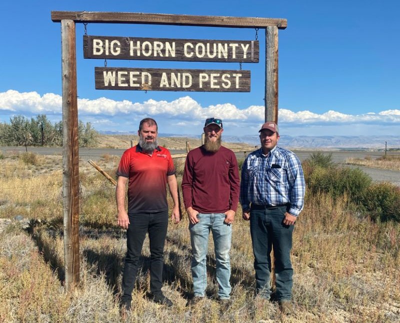 Big Horn County (WY) Weed & Pest selected FieldSeeker to meet its data collection and reporting needs in late 2020. FieldSeeker provided the following benefits during the first field season using it:
- Enabled more efficient tracking and organization of projects
- Reduce human mistakes with data management and data entry
- Labor savings from using FieldSeeker paid for itself in one field season
- Unlimited technical support helps ensure success with the new system
- Software features are enhanced and evolved based on customer input
Big Horn chose to be an early adopter and beta tester to help us evolve and enhance the program, and they’ve been great to work with! We recently sat down with Porter Jones, the Assistant Supervisor, and reviewed their experiences during their first full field season. Here’s what they had to say.
- Can you briefly describe your operations?
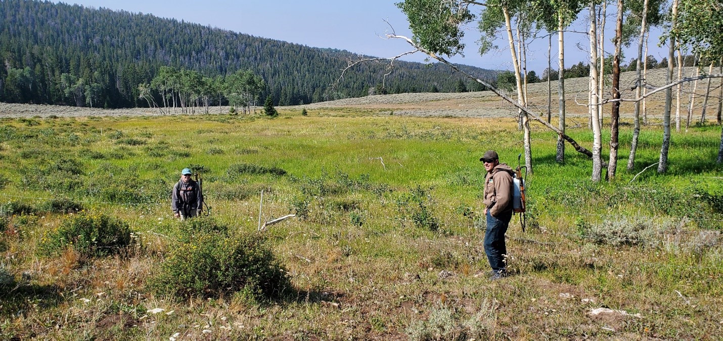
The Big Horn County Weed and Pest Control District is a County based special district authorized by Wyoming Statute 11-5-103. The purpose of the District is to implement and pursue an effective program for the control of designated noxious weeds and pests. To do this, the District offers various cost share programs to private landowners where District crews or private contractors apply herbicides to control noxious weeds. The District also does contract work to treat noxious weeds for various state and federal agencies. Lastly, we offer certified weed free product inspections for hay, straw, and gravel producers. The FieldSeeker platform has enabled us to more efficiently track our efforts across all of these projects/programs.
- What made you decide to use the new system, compared with what you used to do? (What were your “pain points” previously?) What problems did the new system solve for you? (What are the top benefits you’ve experienced?)
We decided to adopt the FieldSeeker platform because we could see that it would be a much more efficient and precise way to track our various treatment activities. Before we used FieldSeeker, we tracked all of our treatment data using handheld GPS units and a spreadsheet based reporting app. We had to manually relate the GPS waypoints to each treatment record. This took a lot of time and labor to do, plus there were always human mistakes throughout the process. FieldSeeker has streamlined this process in the fact that each treatment record that is created is already tied to a georeferenced feature on a cloud based map. The time/labor savings alone have made it worth the switch. We also saw FieldSeeker as a way to keep better track of all the jobs that we needed to accomplish within a given timeframe. Before switching to FieldSeeker, we either used a binder full of paper maps or a Microsoft ToDo list of all the jobs we needed to accomplish during the season. It was easy to lose track of jobs this way and it took a lot more time to coordinate the efforts of our various crews and contractors. FieldSeeker has simplified our logistics because each technician is able to access a customized list of all the jobs they are assigned to accomplish. They are also provided the location and any other specific instructions for each job right in the FieldSeeker mobile app.
- How easy was it to learn to use?
There is definitely a respectable learning curve to FieldSeeker. However, anyone with some basic knowledge of geographic information systems should be able to figure out the system fairly quickly. The FieldSeeker tech support is great. They have answered all our questions and have worked tirelessly to help us not only to learn how to use the system but to customize it to fit our needs.
- What additional things are you looking to improve on, implement or add next season?
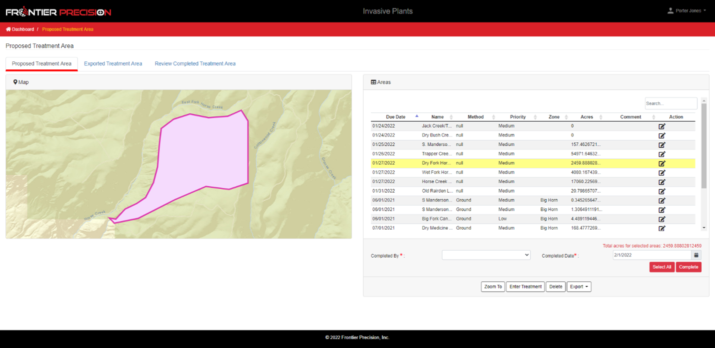
The most important improvements we are looking to make before next season are improvements to the treatment entry/inventory tracking functions. This past season the tank mix creation tool and treatment entry workflow were done on a volume to volume basis. This of course did not allow dry products to be incorporated into tank mixes. We are working with the FieldSeeker team to get these changed to a per acre basis. Creating tank mixes and entering treatments on a per acre basis will improve inventory tracking and facilitate the incorporation of dry products into the tank mix creation tool and treatment entry workflows.
In short, FieldSeeker GIS for Invasive Plants Control is built for today’s workflows and workforce, and it’s aimed at modernizing data collection and data management. The many benefits offset the time and effort it takes to implement a new system or new technology. Increased efficiency means that valuable staff time can be spent elsewhere. Time is money, so time saving means the system pays for itself quickly. Our unlimited technical support and remote training helps ensure success. Software updates including new features and bug fixes ensure that the software continues to evolve to meet your needs. Best of all, you are in control of your maps and data, and you can configure and manage the system in the way that works best for you.
If you are interested in scheduling a demo or purchasing the software, Contact us today for information and pricing. You can also request access to our fully functional testing environment so you can try everything out and see how the system can work for you.
You may also be interested in viewing one of our recorded webinars:
FieldSeeker GIS for Invasive Plant Control Webinar February 2021
How to Use the Benefits of Web GIS for Invasive Plant Control Activities
If you have questions, please contact us.
Linda Glover, Sales Manager, (208) 324-8006
Chad Minteer, Product Manager, (208) 595-1435
* All trademarks are registered or recognized trademarks of their respective owners. Trademarks provided under license from Esri.
Solutions
Frontier Precision provides world-class solutions for a wide variety of industries using leading products, training, technical services and more.


Products
Technical Services
If you require customized technical services and training, please contact Frontier Precision at 800-359-3703 or reach out to a local Frontier Precision location.
Training and Events
Frontier Precision offers affordable regularly scheduled certified training classes, online eLearning, webinars, as well as custom training options to meet your specific training needs.
About Frontier Precision
Contact Frontier Precision
