


ESRI UC 2026
EVERY FLIGHT IMPROVES YOUR NEXT DECISION
Field-To-Finish Intelligence • Unmanned, GIS & Geospatial Technologies • Connected to ArcGIS
GIS Workflows That Connect Field to Office — From Capture to Action
Most organizations have data. What they lack is a workflow that turns it into something usable.
That’s the problem Frontier Precision has been solving for 37 years. At ESRI UC 2026, we demonstrated Field-to-Finish Intelligence — a complete workflow that connects aerial capture, high-accuracy GNSS field collection, and 3D scanning directly to ArcGIS Online, with Site Scan for ArcGIS as the transformation layer between what your platforms collect and what your GIS can act on.
The result: GIS data that’s current, authoritative, and operational — not stale, not siloed, and not waiting on a manual post-processing pipeline.
THE FIELD-TO-FINISH INTELLIGENCE FRAMEWORK
Every workflow that touches ArcGIS runs through four stages. Frontier Precision covers all of them —
hardware, software, training, and support — so your data moves from collection to decision without
leaving the ArcGIS ecosystem.
Capture data from the field — aerial LiDAR and photogrammetry (YellowScan, Trinity Pro, Astro Max), high-accuracy GNSS, 3D scanning, and field apps (ArcGIS Field Maps) — all with mission-grade precision.” _builder_version=”4.27.7″ _module_preset=”default” row_text_text_align=”left” global_colors_info=”{}”][/difl_datatableitem][difl_datatableitem row=”TRANSFORM
Site Scan for ArcGIS processes raw captures into georeferenced point clouds, orthomosaics, and elevation models — automatically organized and stored in ArcGIS Online, ready for analysis.” _builder_version=”4.27.7″ _module_preset=”default” row_text_text_align=”left” global_colors_info=”{}”][/difl_datatableitem][difl_datatableitem row=”CONTEXTUALIZE
Layer transformed data over infrastructure records, permit boundaries, regulatory maps, and historical baselines. Every flight becomes part of an evolving operational picture.” _builder_version=”4.27.7″ _module_preset=”default” row_text_text_align=”left” global_colors_info=”{}”][/difl_datatableitem][difl_datatableitem row=”OPERATIONALIZE
Push intelligence to ArcGIS Dashboards, StoryMaps, and Field Maps. Close the loop from capture to briefing — stakeholders see what’s happening, field crews know what to do next.” _builder_version=”4.27.7″ _module_preset=”default” row_text_text_align=”left” global_colors_info=”{}”][/difl_datatableitem][/difl_datatable]
Collect. Transform. Contextualize. Operationalize. Every flight improves the next decision.
What Your Organization Gains
Our audience is data- and output-driven. These are the measurable changes organizations see when Field-to-Finish Intelligence becomes standard operating procedure.
Decision-makers see what’s happening across every project site — in near real-time, from any device.” _builder_version=”4.27.7″ _module_preset=”default” row_text_text_align=”left” global_colors_info=”{}”][/difl_datatableitem][difl_datatableitem row=”FASTER DECISION-MAKING
Capture to ArcGIS Dashboards in hours, not weeks. No manual post-processing pipeline required.” _builder_version=”4.27.7″ _module_preset=”default” row_text_text_align=”left” global_colors_info=”{}”][/difl_datatableitem][difl_datatableitem row=”REDUCED INSPECTION COSTS
Automated, standardized workflows replace manual data compilation — fewer field revisits, less rework.” _builder_version=”4.27.7″ _module_preset=”default” row_text_text_align=”left” global_colors_info=”{}”][/difl_datatableitem][difl_datatableitem row=”IMPROVED COMPLIANCE DOCUMENTATION
Compliance deliverables generated automatically from the same data your field crew already captures.” _builder_version=”4.27.7″ _module_preset=”default” row_text_text_align=”left” global_colors_info=”{}”][/difl_datatableitem][difl_datatableitem row=”SINGLE SOURCE OF TRUTH
One ArcGIS Online environment for every stakeholder — field crew, project manager, executive, regulator.” _builder_version=”4.27.7″ _module_preset=”default” row_text_text_align=”left” global_colors_info=”{}”][/difl_datatableitem][difl_datatableitem row=”STANDARDIZED WORKFLOWS
Every flight feeds the same system. Consistent methodology means every flight improves the next decision.” _builder_version=”4.27.7″ _module_preset=”default” row_text_text_align=”left” global_colors_info=”{}”][/difl_datatableitem][/difl_datatable]
THE FULL PLATFORM STACK – FROM SKY TO SYSTEM
At Booth #419, the Frontier Precision team demonstrates the complete Field-to-Finish workflow — every platform in the stack, every solution category, all connected to ArcGIS. We cover the full workflow from capture to dashboard, with the training and support to make it operational in your environment
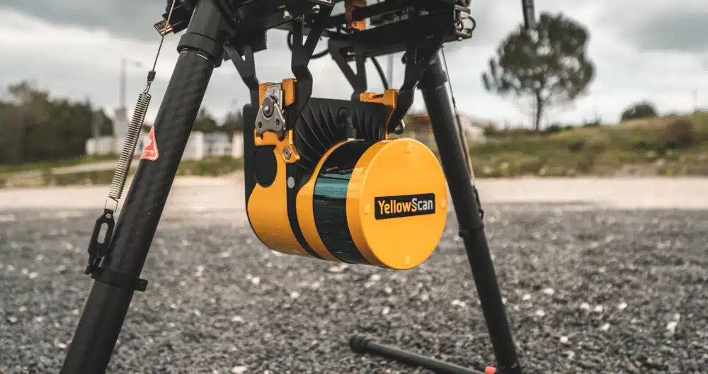
YELLOWSCAN NAVIGATOR PRO
LiDAR Sensor
High-density aerial LiDAR for corridor mapping, canopy analysis, and infrastructure inspection. Centimeter-accurate point clouds via integrated GNSS/IMU.
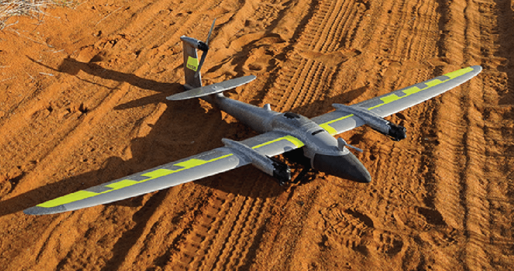
QUANTUM SYSTEMS TRINITY PRO
Fixed-Wing UAS
VTOL fixed-wing with 90-min endurance. Large-area surveying at under 3 cm/px GSD with onboard PPK — optimized for Site Scan workflows.
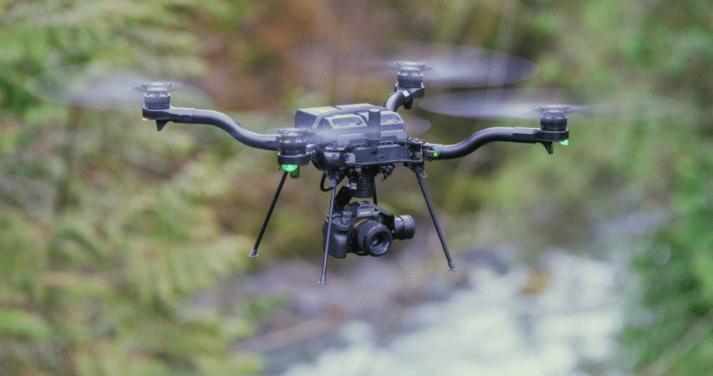
FREEFLY ASTRO MAX
Heavy-Lift Multirotor
Payload-flexible platform for LiDAR, multispectral, and thermal sensors. Designed for challenging environments and extended mission profiles.

FLYBOTIX ASIO X
Confined-Space UAS
Dual-rotor design for GPS-denied indoor and confined-space inspection — substations, tunnels, tanks. Captures photo and video without GPS.
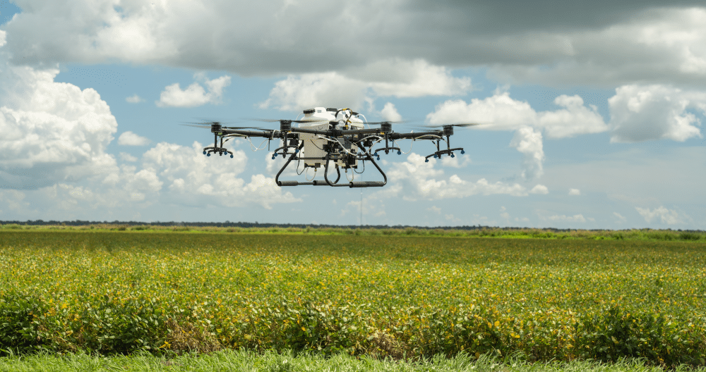
HYLIO ARES 150
Agricultural UAS
15L precision spray system, NDAA-compliant. Purpose-built for large-scale agricultural field operations and precision application workflows.

ACSL SOTEN
NDAA-Compliant UAS
Japanese-manufactured multirotor with full NDAA compliance for sensitive government and infrastructure projects. Zero foreign components of concern.
Also Featured
- High-Accuracy GNSS (Trimble, Leica, and others)
- Mobile Data Collection (ArcGIS Field Maps, Survey123)
- 3D Scanning & Mobile Imaging
- Laser Rangefinders
- Damage Prevention Solutions
- Water Monitoring