ArcGIS Online For Local Government Part 4 of 5: Land Records
Using Esri® ArcGIS® for Local Government and the Local Government Information Model (LGIM), governments can maximize their operations through innovative use of GIS with the latest tools and resources. With an emphasis on commercial off-the-shelf (COTS) solutions, local governments can now deploy select applications from a wide set of web maps, web apps, data models, and other ArcGIS tools focused upon empowering local governments to meet their operational duties.
In this series of blog posts, we will cover different focus areas making up ArcGIS for Local Government. This is part four of five, focusing on ArcGIS for Land Records. Click to view part one on Water Utilities, part two on Public Works, or part three on Fire Service, Emergency Management, & Law Enforcement.
Land Records
The Land Records focus area helps governments and agencies manage an accurate inventory of real property, describe who owns the land, analyze land value and associated improvements, and maximize tax property revenue.
There are several collections that provide specialized maps, apps, and tools to get started with maintaining land information. Here are a few that make up the collection.
Parcel Editing
The Tax Parcel Editing map organizes the survey framework, subdivisions, lots, tax parcels and encumbrances in a fabric data model that can be maintained with the ArcGIS for Desktop Parcel Editor toolbar.
It is an editing map that can be used by local government mapping technicians in an Assessors Office, Public Works agency, Register Of Deeds Office, or any other agency responsible for managing land records information.
The Parcel Editor toolbar contains the tools and menu commands needed to access and work with your parcel fabric, for example, the Select Parcel Features tool, the New Parcel tool and the Parcel Details dialog box. Other parcel editing tools and commands such as the Maintain Control Points dialog box and the Parcel Explorer window are also available on the Parcel Editor toolbar. You can also start and stop an edit session from the Parcel Editor toolbar.
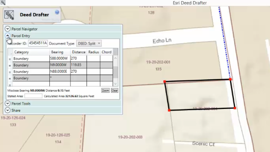
Another tool that works with the Parcel Editor toolbar is the Deed Drafter. The Deed Drafter solution helps mapping technicians enter metes-and-bounds descriptions from deeds and recorded documents and check for closure errors.
Deed Drafter includes a data entry grid that can be used to enter a single parcel traverse from its bearing and distance calls. Existing parcel information can be used as a backdrop so encroachments can be visualized quickly and addressed before submission or recording. Once complete, the parcel boundaries can be saved to a cadastral XML file so it can be appended to a new parcel and incorporated in Parcel Editor workflows.

Tax Parcel Viewer Application
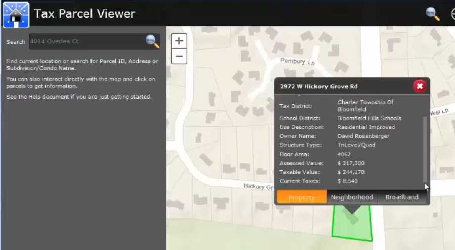
Tax Parcel Viewer is a configuration of ArcGIS and a JavaScript application that presents the general public property tax and assessment information and also provides neighborhood and broadband information. It is viewable by citizens on desktop computers, smartphones, and tablets. Citizens can also submit feedback for particular addresses by describing the changes needed and even drawing on the map. You can also view all the sales and foreclosures in neighborhoods.

Land Use Public Notification Application
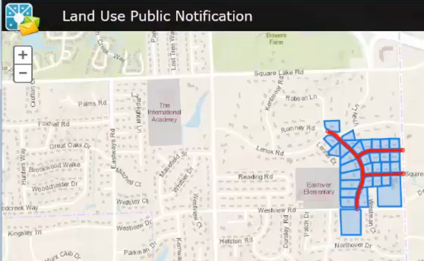
The Land Use Public Notification is an ArcGIS and JavaScript application that allows local government staff to identify properties within a given distance of a subject property and generate mailing labels or a structured text file of owners and occupants who fall within the buffer. This can be used to notify property owners and occupants of formal actions.

More Information
These are just a few examples of everything making up the Land Records focus in ArcGIS for Local Government. For a demo and more detailed information on these tools, please join us on Wed, Jan 27, 2016 10:00 AM – 10:30 AM MST for our webinar: ArcGIS Online For Local Government Webinar Series: 4 of 5 Land Records. View recorded webinar.
As always, contact us if you have any questions or would like more information.


