Frontier Precision Helps Map Kilauea Lava Flow
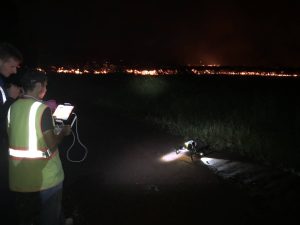
FROM LEFT TO RIGHT: Students from the University of Hawaii – Rose Hart, Grad Student and Roberto Rodriguez, PhD Student, along with Nathan Stephenson – Frontier Precision Applied Geospatial Engineer — mapping the Hawaiian lava flows.

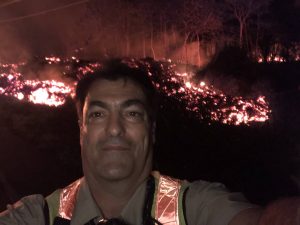
Brennan O’Neill – Hawaiian Branch Manager of Frontier Precision
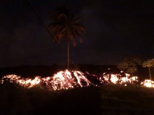
“I had to help out. It was tearing at my soul.” When Kilauea started erupting on the Big Island of Hawaii on May 3, Brennan O’Neill knew he had to do something. As the Hawaiian branch manager of Frontier Precision, he was in a unique position to offer support. Frontier Precision has been at the forefront of geospatial measurement technology for 30 years and was ready to provide free access to technology and expertise to assist in mapping the lava flow.
“I’m a resident of Hawaii,” said Brennan. “For a geologist, it’s even more powerful than that. The lava flow is like a living mass that has a mind of its own, creeping, glowing — an upside-down conveyor belt surging forward and burning everything in its path.”
While the lava can’t be stopped, it can be mapped. Through Frontier Precision, Brennan offered high-tech mapping equipment, his own expertise, and the assistance of Nathan Stephenson, an applied geospatial engineer currently working in the company’s Denver office.
“We used a combination of Trimble R10s and Trimble R8s to gather accurate data points on the ground,” said Nathan. The mapping team flew UAS drones over the flow to gather visual imagery data, matched it to the ground reference points, stitched the photos together and draped it over county maps. The process was repeated as often as needed – daily, and sometimes even hourly – to show the speed and direction of the flow.
Nathan isn’t new to mapping lava flows. As a graduate student at the University of Hawaii – Hilo, he worked on collecting data on the Pahoa eruption in 2014, and he’s seen advances in technology in just a few years. “One thing we have now that we didn’t have in 2014 was a thermal radiometric camera that helps us map more accurately at night and enables us to capture large heat signatures.”
The collected data helps Hawaii Civil Defense and other agencies keep the public informed and safe, and in the long term it also contributes to the store of scientific knowledge about eruptions and lava flow behavior.
The lava flow has formed a channel that now extends out to the ocean. It poses no immediate threat to structures or people aside from gas emissions but could change at any time. Nathan has returned to his home in Denver, but if the situation changes, he would come back to Hawaii. “It was a great experience and I was glad to offer my support. If they need me again, I’ll be there.”
Frontier Precision would be glad to offer assistance as well if needed in the future, whether that be with equipment or with personnel. “Scientific measurement is what we do, and when we can help out on a project like this, it’s the right thing to do and we have the equipment and expertise to get the job done.”


