GIS Dashboards for Mosquito Control Operations
One of the most sought after features for mosquito control Operations Managers and management staff in general is a GIS dashboard. Getting data into systems such as FieldSeeker GIS and Sentinel GIS is only part of the solution – it’s getting data back out in a usable, actionable form that is often the “holy grail” for managers. Reports provide a summary of work that has already been done, but dashboards provide a picture of what’s going on now. Putting this information together allows managers to allocate resources effectively and make informed decisions.
Operations Dashboard for ArcGIS is exactly what managers are looking for. Creating focused executive dashboards that integrate maps, charts, and graphs using a configurable widget framework is a powerful way to deliver GIS business intelligence to the people who need it the most. Best of all, the users don’t need to know anything about GIS to use it.
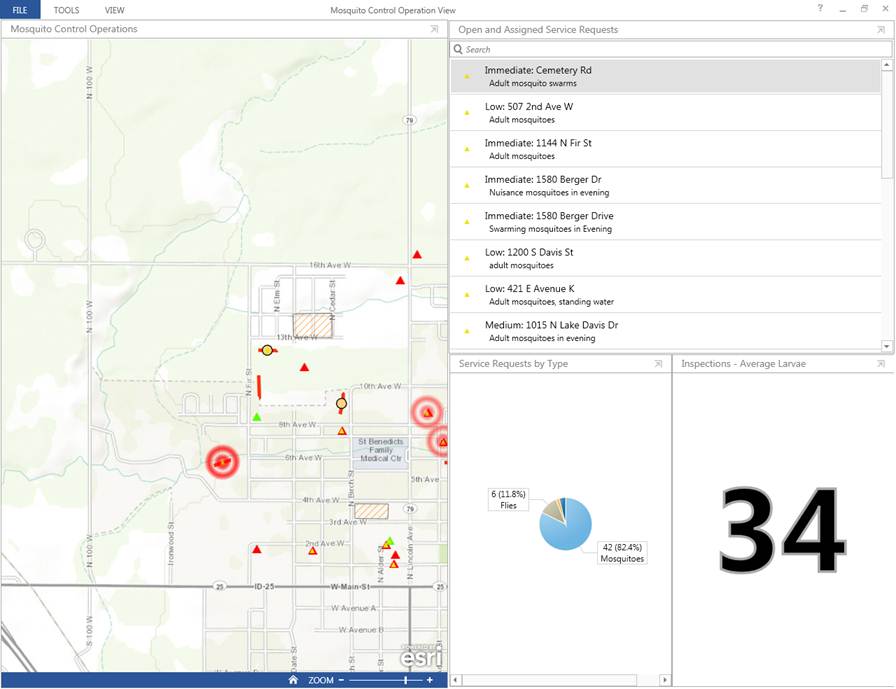
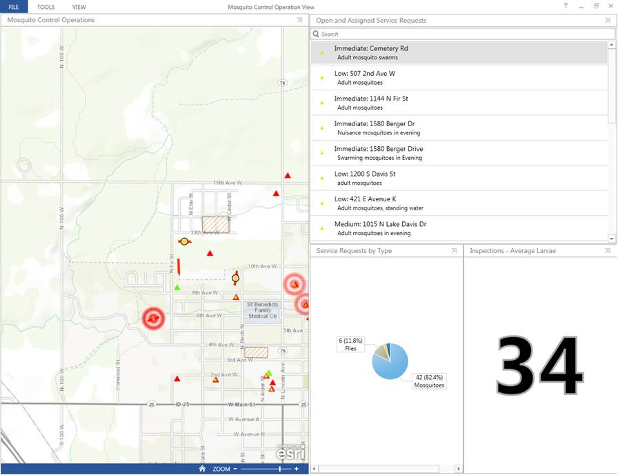
In the example below, FieldSeeker GIS service requests and mosquito site locations are displayed on a map along with a list of open and assigned requests, a summary chart showing requests by type, and a statistic showing average larvae in recent mosquito dip inspections.
All elements are interactive. For example, clicking on the “Flies” category in the chart highlights the corresponding Service Request locations on the map (this is shown below). All data is dynamic and real-time.
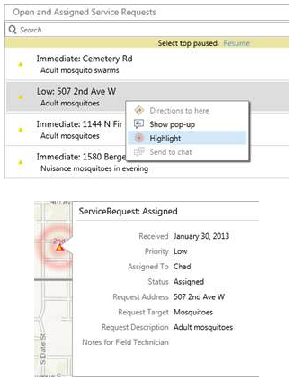
Right-clicking one of the open or assigned service requests presents options such as highlight, show pop-up or get directions (if the dashboard is viewed on a tablet, this option is enabled).
Dashboards are easily created, edited, and configured by adding more widgets.
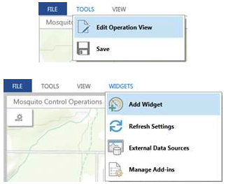
A wide variety of widgets are available out of the box.
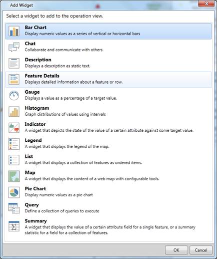
All widgets are configurable.
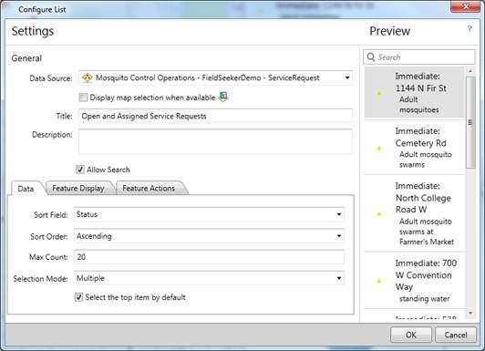
The Operations Dashboard is also extendible, meaning that custom widgets can be developed as add-ins.
Different dashboard views can be created that focus on specific needs. For example, in addition to a dashboard focusing on Service Requests, a supervisor could set up a dashboard focused on landing counts and weather, or predicted flooding related to mosquito site location. We’ll take a closer look at these and other scenarios in future blog posts. We’ll also take a look at some of the other ready-to-use apps that are available to ArcGIS Online users.
Operations Dashboard is one of the ready-to-use apps that are available to ArcGIS Online users who have an organizational account. What most people don’t know is that if they have ArcGIS Desktop, they already have an ArcGIS Online organizational account. Please contact us for help configuring your organizational account and for help setting up your dashboards. As an ArcGIS Online Specialty Partner for Esri, we offer services and training to help you get the most out of the Esri Platform.


