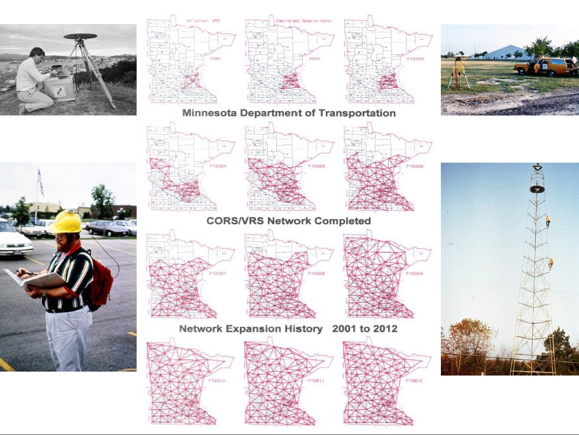
MnCORS Network Change 03/03/2020
The MnCORS Network will be transitioning to new servers and software on March 3, 2020. This transition will possibly require a few changes for users. In most cases the account information that you have been using will continue to work properly after the transition and no configuration changes should be necessary.
The new software will have the capability to send L5 and Galileo signals. In order to use these new signals, your equipment must be licensed by your distributor and/or activated in your controller. This will vary depending on the type of receiver you are using. For Trimble R10, R10-2 and R12 users, you will automatically have the capability to utilize these new signals. These will be especially advantageous for Trimble ProPoint GNSS users. If you are using Trimble field software, you must use the CMRx mount point moving forward.
The new mount point list will be as shown below. It is extremely important that you utilize the CMRx mount points moving forward, if capable. Most Trimble receivers should be able to utilize CMRx. However, the CMR+ mount point will still be available for some of the older legacy receivers still in use. If you plan to utilize the Glonass, L5 and Galileo constellations, you will need to use CMRx in order to be successful.
To utilize the newly added L5 and Galileo signals, you will need to enable them in your survey style in Trimble Access. To do this, pick the menu button and choose Settings/Survey Styles.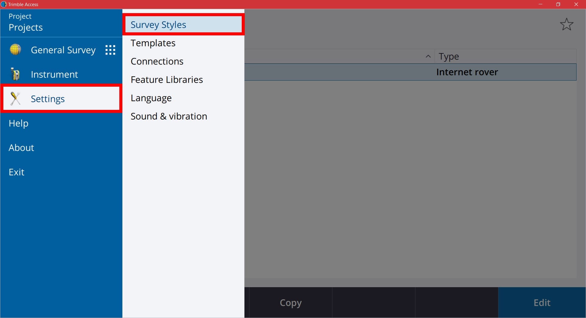
In the Survey Styles screen you will see your list of styles currently on your controller. Select your VRS survey style from the list. If it is highlighted, you can also pick the Edit button. 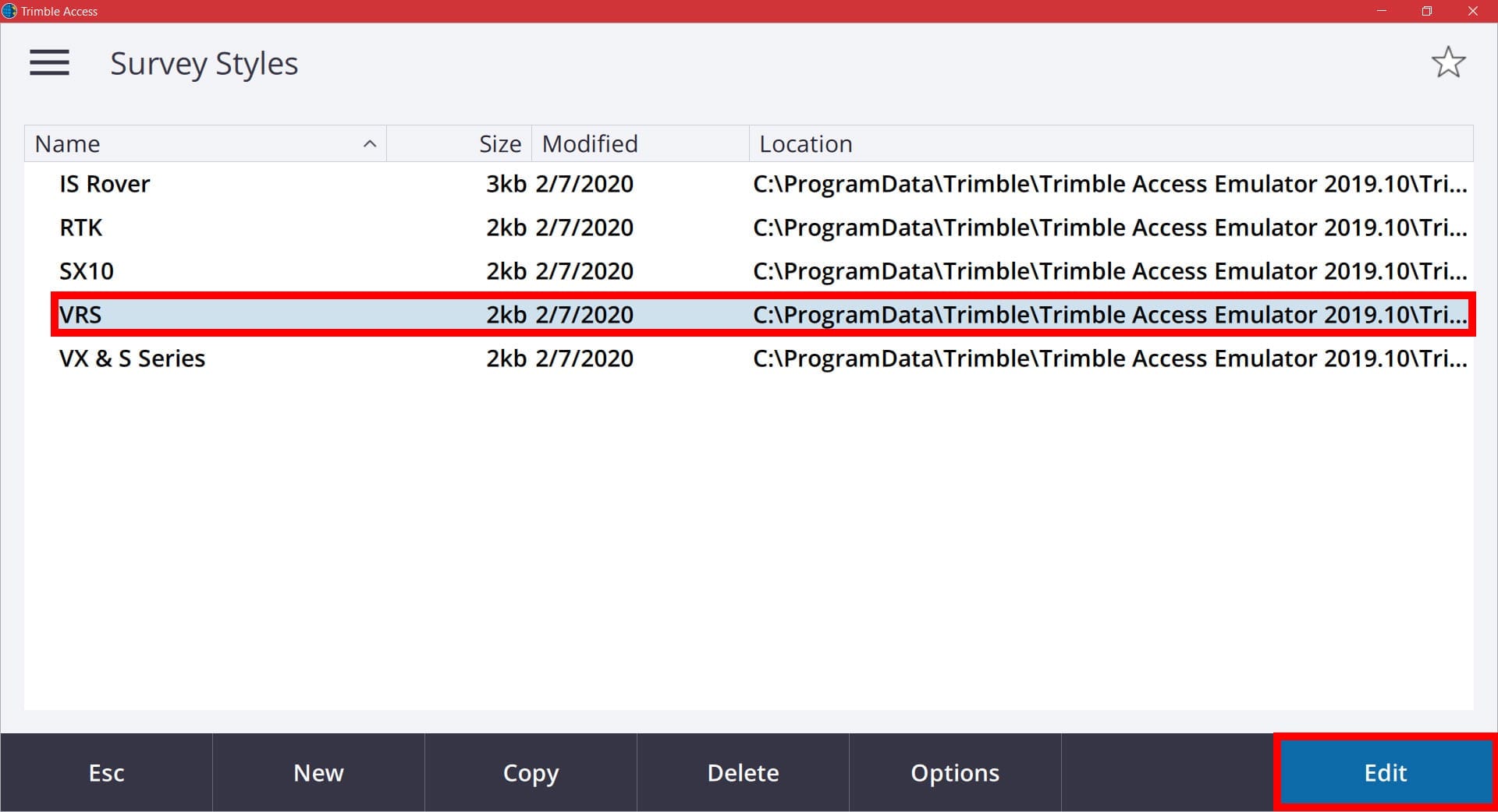
In the next list of settings for your VRS survey style, select Rover Options from the list.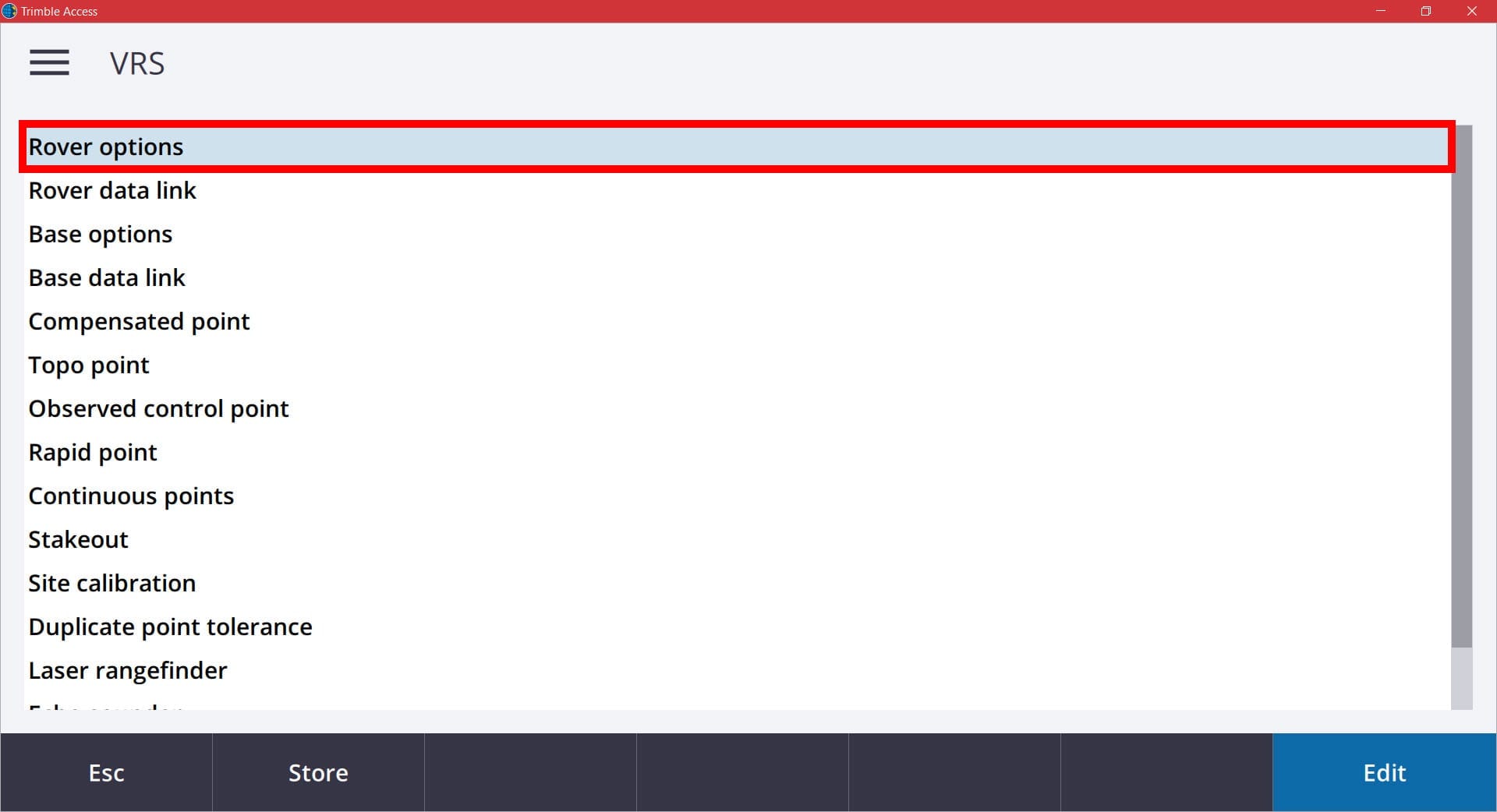
In your Rover Options, ensure that your Broadcast Format is set to VRS (CMR) and that your Store points as is set to Vectors. 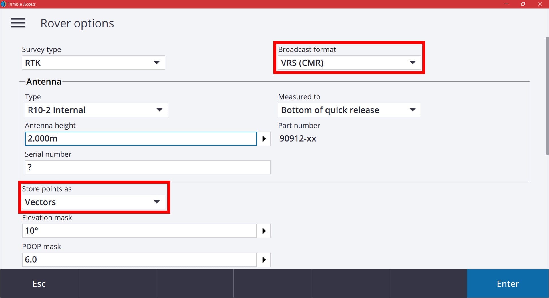
Then scroll down to your SV Signal Tracking settings. Here you will see check boxes for the different GNSS constellations that you want your rover to utilize. Ensure that the L2C and Glonass boxes are checked. If your receiver is capable of utilizing L5 and Galileo, check those boxes as well.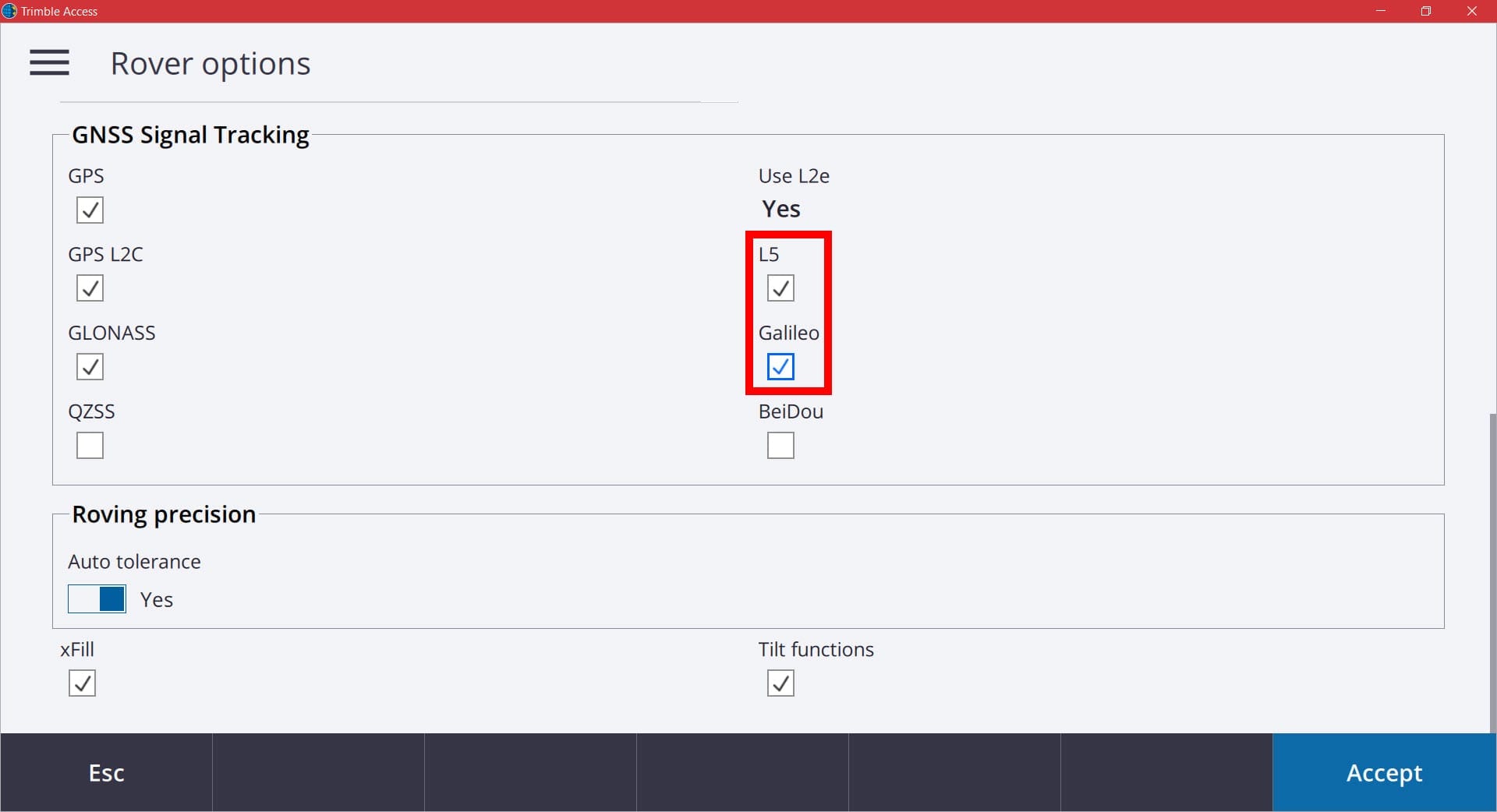
When your settings have been changed, pick the Accept button to go back to the survey style settings screen. In order to save all of the changed you have made, you need to make sure you pick the Store button at the bottom of the screen. Otherwise, all changes will be lost. 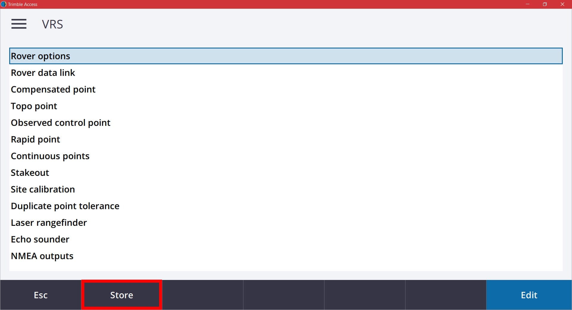
All users that have used their account during the previous year of 2019 will have their current username and password activated on the new system. All accounts that were newly created in the 2019 and 2020 year will also be activated on the new system.
The existing IP address of “mncors.dot.state.mn.us” will remain the same and automatically be redirected for communication on the new server on March 3rd. The existing IP address of “mncors2.dot.state.mn.us” will be deactivated on March 3rd. Users that are currently using this IP address will need to change this setting in their GNSS Contacts in Trimble Access on or prior to March 3rd.
To check this or make the setting change, you will want to pick the menu button and choose Settings/Connections/GNSS Contacts.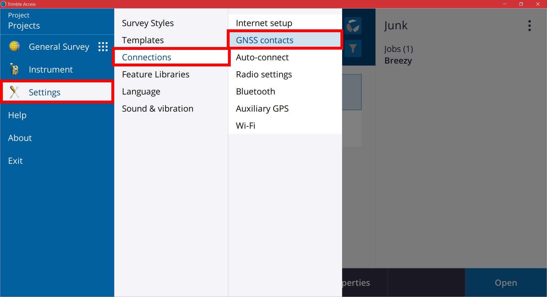
In the GNSS Contacts screen you will see your existing contact (if you already have one) You also have the ability to create a new GNSS contact here if needed. To edit the existing one, tap it on the screen or if it is highlighted, pick the Edit button. To create a new one, pick the New soft key. 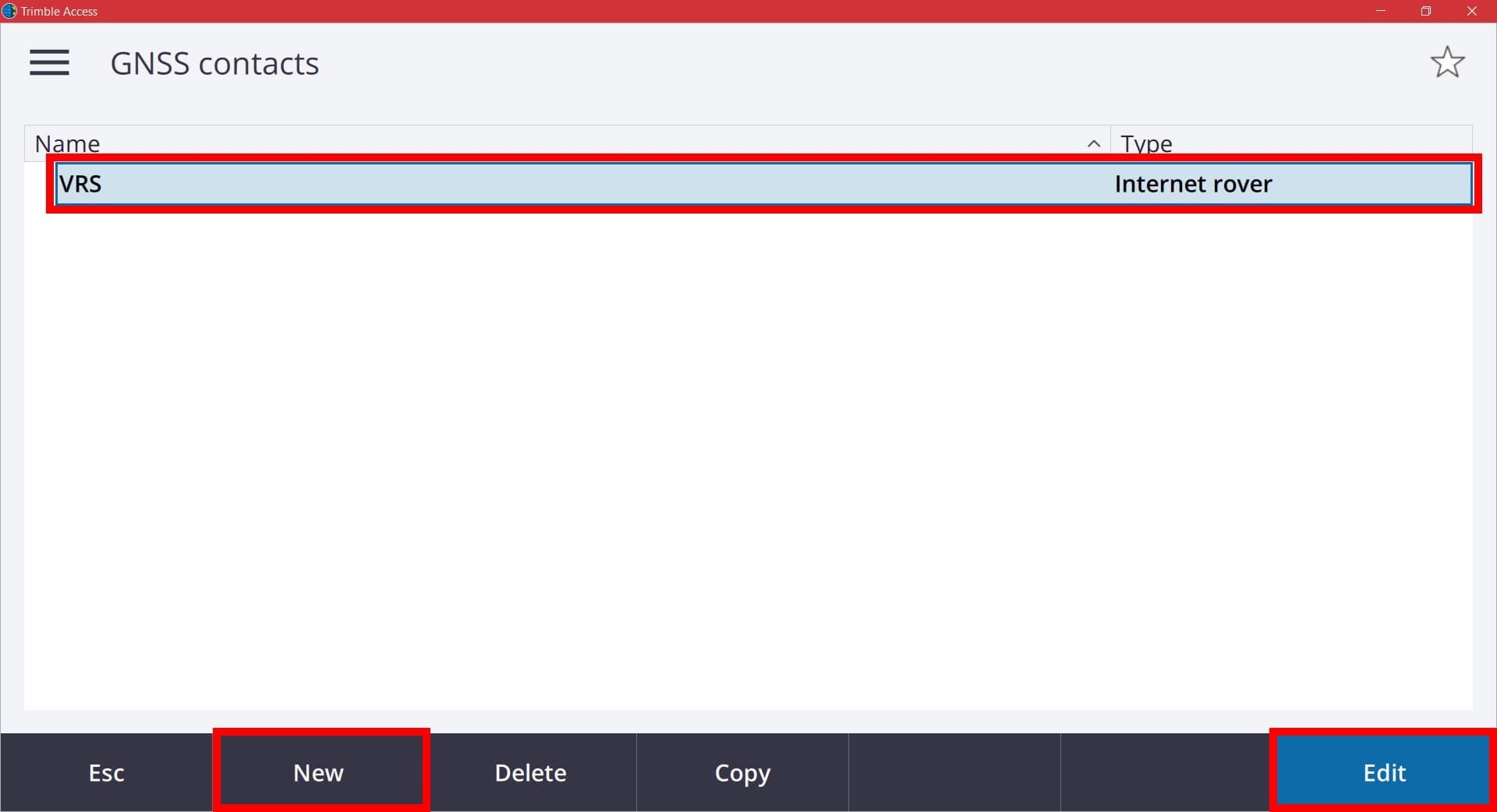
In the Edit GNSS Contact screen you will want to look for the settings for the IP Address and Port. In order to work on the new server environment starting March 3rd, you will need your IP Address and Port to be entered in as shown below. 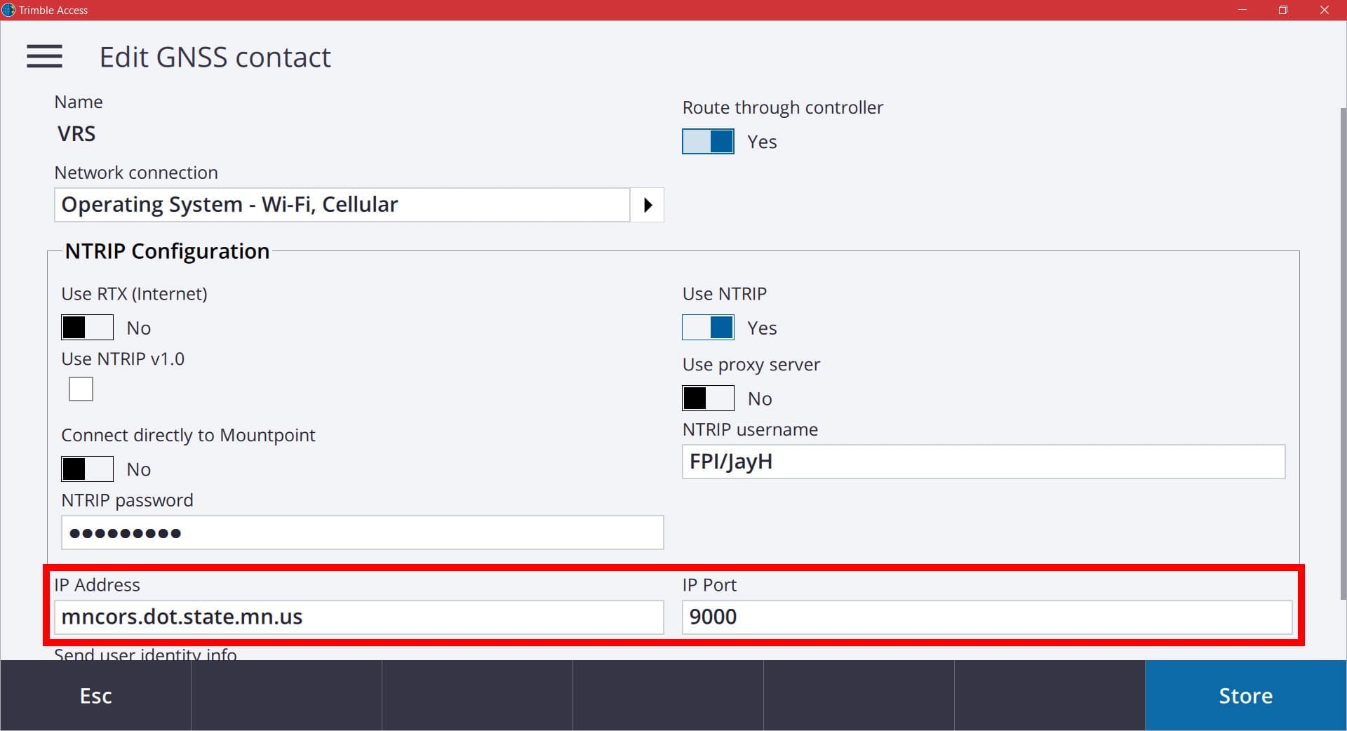
When finished, pick the Store button to store the changes.
There will also be coordinate shifts (generally 2cm or less) between the old and new software environments in order to better represent the National Spatial Reference System (NSRS). The software is based on the NAD83 (2011) adjustment and transformed to the 2007 and the 1996 adjustments. Please refer to FAQ #11 on the MnCORS FAQ page.
IMPORTANT: Be sure to calibrate any NEW projects to previously measured control from the old system in order to be able to work in the same coordinate reference. It is always recommended to calibrate new jobs to a known point or geodetic control point on or near your project. DO NOT re-calibrate a previously calibrated job file. If you are working in a current job from the old system after the change to the new system, you will need to create a new field job file and either import the points from the old file or link the old file, then calibrate the new file to it. This will ensure you retain the integrity of your original measurements, but will still be working on the new server environment.
If you have any additional questions, please contact your local FPI office for assistance.


