As a mosquito control professional, do you sometimes find it challenging to locate mosquito breeding sources in difficult to access areas? Or do you wish you had a better method to inspect properties using an aerial view to identify potential breeding sources? Exciting new technology using Unmanned Aircraft Systems (UAS) may be the perfect solution for you. Highly accurate photographs, paired with image processing technology and advanced sensors, make UAS an exciting technology platform for mosquito control organizations.

Several months ago, our company was granted a Section 333 exemption from the Federal Aviation Administration (FAA) that allows Frontier Precision to legally operate UAS for commercial purposes. We are very excited to now offer aerial mapping and survey services using UAS equipment, services that may be very useful for mosquito control organizations.
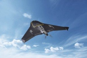
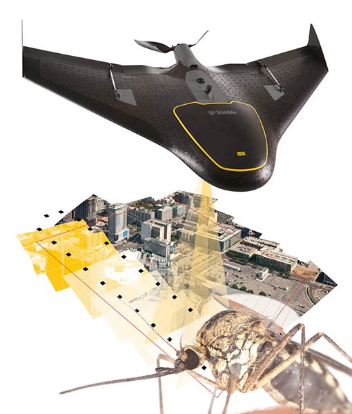
The technology behind UAS allows small multi-rotor or fixed-wing aircraft to collect high resolution digital images over many acres in a single mission. Using on-board positioning technology, these high resolution images are spatially accurate and are ideally suited for detecting potential mosquito breeding sources. These images are also directly compatible with Geographic Information Systems (GIS), a terrific technology for mosquito control professionals.
UAS devices provide a payload bay that allows different imaging sensors to be mounted, depending upon the user’s needs. Typically the payload includes a true-color high-resolution camera for taking color photographs covering many acres. These images may be used to identify mosquito breeding habitat by visually analyzing the photographs for standing water or for determining suitable habitat such as tire piles or construction debris. This type of visual analysis can be very helpful when identifying potential breeding sources in difficult to access areas, whether it is behind locked gates or in a remote area far from access roads.
Additionally, these true-color images may be processed using specialized software to create topographic maps for a small area and even creating 3-D models of the region. These processed images can be used to determine low areas and basins that are likely to collect water and become mosquito breeding sources, particularly after rain events. Highly accurate topographic maps of small areas are an often over-looked resource that can prove very valuable to mosquito control organizations.
The UAS payload bay may also include multi-spectral or infrared camera sensors that are very useful in classifying vegetation by type. The output from these cameras can help identify areas with standing water and also classify vegetation by type – which can be an indicator for suitable mosquito control breeding habitat.
Looking into the future, UAS tools and payloads may also advance to become even friendlier to mosquito control professionals. One example of technological advances in UAS developed specifically for mosquito control operations is Microsoft’s Project Premonition, research that couples UAS technology with advanced mosquito trapping and on-board vector disease detection. Look for an upcoming blog post from Frontier Precision that discusses this unique use of UAS technology being developed by Microsoft.
Frontier Precision now offers UAS services for all our customers. The high-resolution, spatially-accurate digital images are very useful for many applications. Please contact us to discuss your aerial imaging needs.
Join us on Tuesday, December 1, for a webinar that describes how UAS technology may be used to help your mosquito control operation. View Recorded Webinar.


