Frontier Precision and Industry News

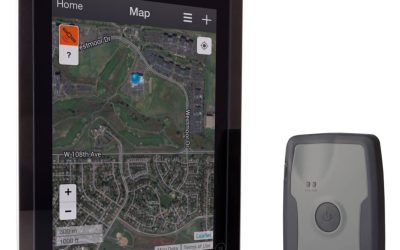
The New Trimble R1 GNSS Receiver is Small but Powerful

The New Trimble R1 GNSS Receiver is Small but Powerful

Smart devices such as iPads and Android tablets are becoming more and more popular for collecting GIS data in the field.  They are affordable, readily available, and powerful and offer benefits that GIS folks like such as a larger view for displaying imagery and...

read more
Trimble Announces Release of R1 Receiver

Trimble Announces Release of R1 Receiver

Today Trimble announced the release of their R1 Receiver. This GNSS receiver is a pocket sized receiver, weighing in at 6.5 ounces that can be used on its own or with iOS, Android, or Windows mobile devices. The R1 reciever is a multi-constilation receiver that...

read more

Tech Talk: Advanced Data Dictionary Creation

This Tech Talk is a continuation of the Basic Data Dictionary Creation video we have published for Trimble GPS Pathfinder Office and TerraSync users. In this advanced video we explain and demonstrate more complex data dictionary features such as conditional...

read more

Technology Webinar Posted- Graphical Road Staking

In this Technology Webinar, we demonstrate the new graphical staking interface in the Trimble Access Roads Module. This is an update to the traditional drop-down menu method of staking, and provides users a more intuitive graphical interface when staking in the field....

read more
Pesky Paperwork for Pesticides

Pesky Paperwork for Pesticides

Simple, efficient, and reliable! Frontier Precision's Pesticide Application Record (PAR) Application is an innovative and cost effective solution for replacing those HUGE stacks of paper work you create for your pesticide applications. Screen shot of the PAR App. Web...

read more
Determining and Defining Coordinate Systems in ArcGIS

Determining and Defining Coordinate Systems in ArcGIS

ArcGIS Toolbox – Define Projection vs. Project   –  What’s the difference? Well the difference is very important.  If you’ve tried to add a shapefile into ArcMap that does not have a .prj file (Projection File), you will get the message that it has an Unknown Spatial...

read more

Tech Talk: Floating License Setup for GPS Pathfinder Office

In this Frontier Precision Tech Talk we introduce you to the License Manager and License Administrator for Trimble GPS Pathfinder Office Software. We provide an on-screen tutorial highlighting the download and installation, as well as the setup for a floating license....

read more
Trimble TerraFlex Advanced released!

Trimble TerraFlex Advanced released!

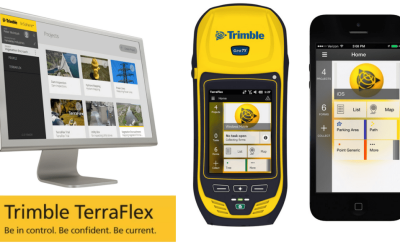
Trimble has released their TerraFlex Advanced edition on January 7, 2015. New capabilities of the Advanced edition: Import existing data from shapefiles Create field collection templates from existing attribute tables/layers Create tasks: Show task progress in field...

read more
Are you a new user of TerraSync and Pathfinder Office?

Are you a new user of TerraSync and Pathfinder Office?

Frontier Precision resources to get you started!  TerraSync and GPS Pathfinder Office Orientation Guide TerraSync Support Page Pathfinder Office Support Page More of a classroom learner? Sign up for a Trimble Certified Training Course!

read more
Basic Data Dictionary Creation

Basic Data Dictionary Creation

Pathfinder Office's Data Dictionary editor is a powerful tool that can create a framework of attributes to collect while recording geospatial points with TerraSync. By using a data dictionary in your data collection workflow if set up properly can reduce the need for...

read more

Tech Talk: Introduction to the Trimble Geo 7x Handheld

You just received your new Trimble Geo 7x handheld... Now what? If you are new to your Geo 7x or are thinking about making the purchase, watch this video to learn about the features, accessories, and resources related to the device. Visit our Geo 7x resources webpage...

read more
Trimble TerraFlex Updated Workflow and Functionality

Trimble TerraFlex Updated Workflow and Functionality

The Trimble TerraFlex software has recently had some major improvements to both functionality and workflow. If you missed the December 10th live webinar, we strongly encourage you to check out the recorded webinar. In this webinar, you'll see the latest updates,...

read more
Is My Integrated Camera Good Enough For GIS?

Is My Integrated Camera Good Enough For GIS?

That is an interesting question and not an easy one to answer. We can start by clarifying that standalone digital cameras take the best pictures. That is clear! Many of today’s smartphones and tablets with their miniature lenses do amazingly well too. What if we look...

read more

Tech Talk: TerraSync Basic Data Collection

This Tech Talk highlights the basic overview of collecting point, line and area features using Trimble's TerraSync software. Checkout some of our other TerraSync videos! Transferring Data Files Best Field Practices for Collecting Geospatial Data Differential...

read more
Beautiful Idaho Story Map

Beautiful Idaho Story Map

Elecdata’s ArcGIS Online site is gaining content.  My favorite addition is the Scenic Byways of Idaho Story Map.  Use the tools in the floating window to scroll through the scenic drives, view videos and click on the many points of interest along the way.  We’d love...

read more

Tech Talk: Full Calibration on Trimble Geo7x Sensors

This is an instructional video on calibrating the Trimble Geo 7x internal sensors.  This calibration is required on all new units.  TerraSync navigation functions will NOT work until this has been successfully performed. Full calibration should be performed: • the...

read more