Frontier Precision and Industry News

Tech Talk: Trimble Access GNSS Emulator

Tech Talk: Trimble Access GNSS Emulator

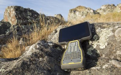
In this video we demonstrate how to utilize the GNSS emulator within Trimble Access. This can be a helpful tool to do some computations, training or demonstrating without having to go outside in the field and starting a full survey.  

read more
Sideloading Basemaps in Collector for ArcGIS For Offline Use

Sideloading Basemaps in Collector for ArcGIS For Offline Use

With the uptake in aerial mapping using drones and other imagery services in recent years, there has been an increased demand for custom basemaps for viewing during field data collection. Viewing imagery in areas with cellular connection can be simple, but how do you...

read more
VectorSurv Gateway Now Integrated with FieldSeeker

VectorSurv Gateway Now Integrated with FieldSeeker

What started as the CalSurv Gateway is now available in California, Arizona, Utah, New Jersey, and Tennessee as the Vectorborne Disease Surveillance System, and other states are looking to adopt the system.  Participating agencies use the Vectorborne Disease...

read more
MnCORS Network Change 03/03/2020

MnCORS Network Change 03/03/2020

The MnCORS Network will be transitioning to new servers and software on March 3, 2020. This transition will possibly require a few changes for users. In most cases the account information that you have been using will continue to work properly after the transition and...

read more
Tech Talk: Trimble Access- Staking with a Reference Alignment

Tech Talk: Trimble Access- Staking with a Reference Alignment

In this video we demonstrate how to stake to a reference alignment. This will allow you to see your current position’s station and offset on an alignment, relative to a referenced road. When doing this, Trimble Access will record the design and reference alignment...

read more
4th GPS Civilian Signal Goes Live

4th GPS Civilian Signal Goes Live

A new GPS civilian signal is now available for use. The new signal is stronger, more accurate, more resilient to interference events, and is inter-operable with the European Galileo system. This is made possible by the first GPS III becoming operational. The new...

read more
Remote Water Quality & Level Monitoring Made Easy

Remote Water Quality & Level Monitoring Made Easy

The new VuLink cellular/satellite transmitter from In-Situ makes remote monitoring easier and more reliable than ever before. VuLink is optimized to work with In-Situ brand water quality and water level instruments with “one-touch setup” and can also be interfaced...

read more
Act Now for 2019 Tax Savings

Act Now for 2019 Tax Savings

Buy or lease the equipment you need now for big savings on your 2019 taxes! The Section 179 tax provision allows businesses to deduct the full cost of qualifying equipment and software purchased or leased by the end of the year.Most small and medium-sized...

read more
S-Series Service Warning

S-Series Service Warning

Have you seen the message indicating that your total station is due for servicing? A lot of times we are asked what this message means, and what should be done when this message appears. This message will come up as a reminder for your S-Series instrument after 3000...

read more
TBC Power Hour: Introducing the Trimble X7 Scanning Solution

TBC Power Hour: Introducing the Trimble X7 Scanning Solution

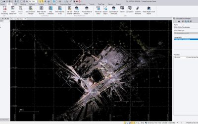
Trimble Business Center 5.20 which is soon to be available, seamlessly supports the new  Trimble X7 data through image-based station views, CAD and drafting tools, point cloud registration, classification, extraction routines and more! Please join us for a webinar on...

read more
SX10 Topographic Scanning Tutorial: Field to Finish

SX10 Topographic Scanning Tutorial: Field to Finish

Often we get asked how to utilize SX10 scan data in TBC and Civil 3D for topographic surveying. Our friends at Trimble have put together an informative series of tutorials to help demonstrate this process. This tutorial video series demonstrates a topographic workflow...

read more
Automatic Water Sampler Comparison

Automatic Water Sampler Comparison

An automatic water sampler is essentially an intelligent pump that takes water from a source and deposits it into one or many bottles. Samplers can do this based on time, flow or some other externally measured parameter(s) such as rainfall, water quality, etc. An...

read more