What’s New in FieldSeeker® GIS – Part 1
The biggest news is that FieldSeeker Mobile software is now available for iPads and iPhones. The iOS Mobile software is a native app, so it’s fast and sleek. It uses the Esri runtime, so it has all the great mapping & GIS awesomeness you’d expect. You can view more information about FieldSeeker GIS for iOS here.
That still shouldn’t steal the thunder from this post though, because the FieldSeeker web app has received some awesome new features too.
On-Truck Inventory Management
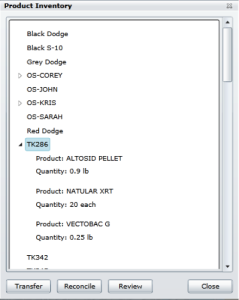
If you’ve ever had to manage paper product tickets to keep track of ‘rolling stock’ and who’s checked what out when, you know how painful it can be to try to match all of that up with treatment totals. No more! FieldSeeker automatically tracks the inventory from the time you transfer it from a warehouse or depot to a vehicle until it’s put out in the field as a treatment. Cyclical physical counts of rolling stock inventory are reconciled and any discrepancies are reported. Product inventory management made simple! FieldSeeker on-truck inventory management is also easily integrated with back-end inventory systems.
Worth a Thousand Words…
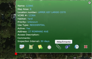
We’ve all struggled with capturing that hard to capture stuff in a data entry form – do I put it in Comments? Well, what about a picture? FieldSeeker now supports picture attachments for locations, service requests, and field inspections. The pictures are visible in the office and in the field, so even if you aren’t familiar with a field site, if someone else recorded good information and took some pictures, you will be up to speed in no time!
Time-Enabled Map Layers
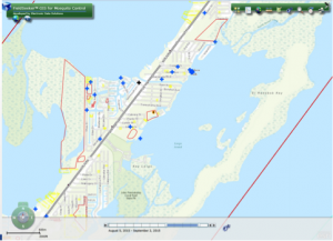
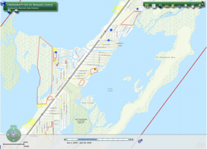
Everyone loves a good summary report, right? Numbers are good – solid, objective, black and white. But what if you could visualize those numbers spatially over time? Time-sensitive data such as service requests, surveillance data (trapping, landing counts), field activities (inspections, treatments), truck spraying, and aerial spraying can all be visualized on a map using a time slider. Identify patterns, hot spots, and trends quickly and easily!
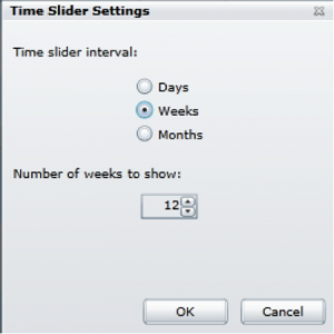
The time slider is easily adjusted to show different intervals of time.

Prescription Spraying
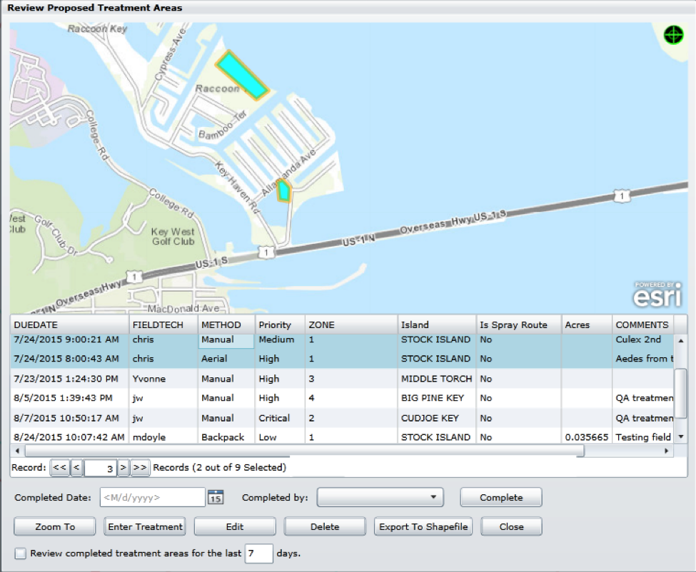
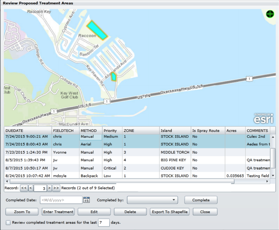
When field surveillance indicates an imminent problem requiring truck or aerial treatment, proposed treatment areas can easily be drawn in or selected from predefined aerial spray blocks by field personnel. Supervisors can review these areas and plan their response with accurate up to date information. When trucks or aircraft are dispatched for treatment activities, they can target only those areas that really need it, saving time and expensive product. Prescription spray blocks can be exported for use in flight guidance systems such as AgNav and SkyTracker.

Public Website Service Request
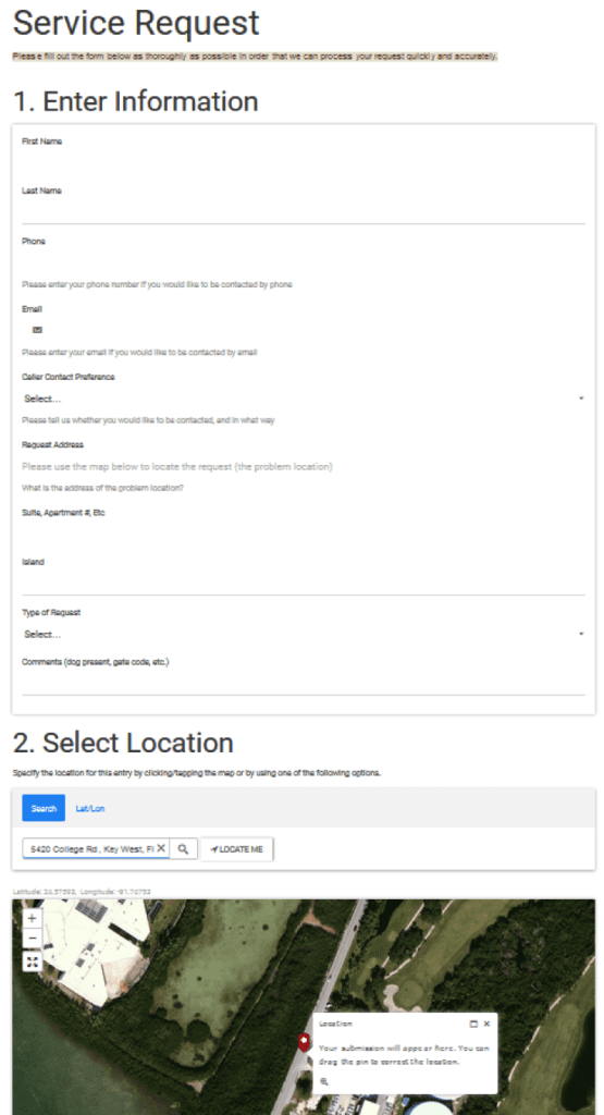
Using ArcGIS Online’s GeoForm configurable app, a Service Request page can easily be added to your external Website. Requests are automatically entered into FieldSeeker, where they can be reviewed and assigned to field staff. Service Requests can also be automatically assigned to a field tech based on operator zone. No more paper map books and looking at zone boundaries on a wall map!
More…
There’s lots more to tell you about. View What’s New in FieldSeeker® GIS – Part 2.


