Fighting Zika With Location-based Intelligence – Putting the Pieces Together
Mosquito and vector control operations have to be smart about engaging the public and using resources for maximum efficiency. Location-based intelligence can help you proactively monitor mosquito activities and target potential high-risk areas so that you’re not spinning your wheels.
We at FrontierPrecision® have been actively involved in developing, implementing, and supporting GIS-based mosquito control software solutions for more than a decade. Our experience has been that using GIS in a targeted manner can improve operational efficiency and provide solid information for intelligent decisions.
Recently, Esri® developed a white paper highlighting the Vector-borne Disease Surveillance Business Solution – a collection of mapping applications that supports vector control organizations in their efforts to fight deadly diseases and educate the public. In this article, we would like to highlight several specific examples from this business solution that can work with any solution you currently have or are planning on using, including FieldSeeker® GIS, Sentinel® GIS, home-grown systems, or other vendor products. These can be put together like puzzle pieces depending on your operations. The examples we’ll consider relate to Public Information, Operational Intelligence, and Efficient and Accurate Fieldwork.
Public Information
Past blog articles and Webinars have highlighted some examples of public information apps, such as the GeoForm and Status Maps. We won’t recap those here, but instead will highlight some additional examples. (Although we can’t help mentioning the Ada County Mosquito Tracker, a great example of a status map for the Boise, ID area.)
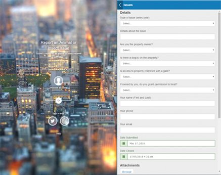
Crowdsource Reporter / Crowdsource Manager
The Crowdsource Reporter mapping application is a simple map + issue report form application that can be shared on your public Website for gathering input from the public. It will show nearby issues, allows voting, supports picture attachments. The Crowdsource Manager app provides a simple set of tools to vet those requests and assign them to particular crews or departments.
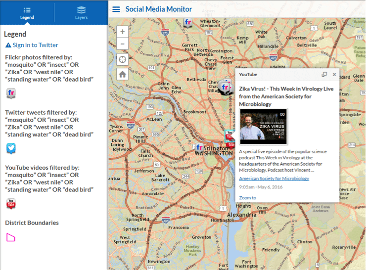
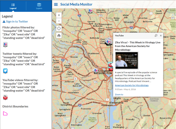
Social Media Monitor
This configurable app lets you monitor, on a map, use of keywords on social media – Flickr, YouTube, Twitter, Instagram and others. This may provide insights into public perceptions, problem areas where people are unaware of or not engaged with mosquito control, and efforts of other agencies, companies, educational institutions, and facilities related to mosquito control in your area.
Operational Intelligence
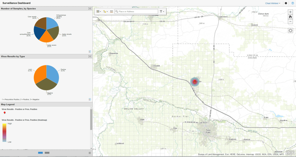
Past blog articles have highlighted operations dashboards, which are endlessly configurable. Suffice it to say that a Surveillance Dashboard showing a time-enabled heat map, species identification and disease testing results is a much easier way to visualize information than a menagerie of spreadsheets and reports.
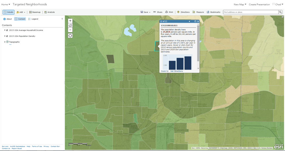
But let’s look at an example of using demographic data such as population density to perhaps help predict areas where neighborhood yard sweeps would be most effective in preventing container mosquito breeding. This map uses Esri Living Atlas demographic data, including household income and population density by census block group, highlighting areas of overlap.
Efficient and Accurate Fieldwork
FieldSeeker GIS and Sentinel GIS are optimally designed for efficient and accurate field data entry for inspections, treatments, trap data, landing counts, service request response, larval samples, Sentinel chickens, dead birds, and other data commonly collected by mosquito and vector control operations. But other puzzle pieces can plug in.
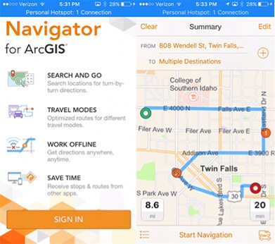
Navigator for ArcGIS
Routing and turn-by-turn directions to your GIS locations, including service request, trap sites, etc. Available for iOS, coming soon to Android. Works online and offline. Interfaces with other apps, such as Collector, Workforce, and FieldSeeker GIS for iOS[1].
Workforce for ArcGIS
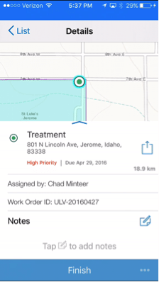
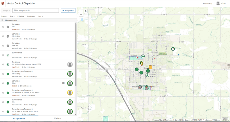
Real-time awareness – where are your field techs, and what are their work assignments? Dispatch work and see status of work in progress. Workforce Dispatcher and Workforce for iOS can be used in conjunction with any system.
Conclusion
Spatial intelligence can help you with your Zika response. Let us help you put the pieces together – from scratch, with an existing system, or with FieldSeeker or Sentinel GIS.
In a future post we’ll highlight in more detail how the Esri business solution compares with and compliments FieldSeeker and Sentinel GIS.
Also join us for our Webinar “Fighting Zika With Location-based Intelligence – Putting the Pieces Together” to be held on June 7, 2016 10 AM MTN. View Recorded Webinar.


