ArcGIS® Online for Local Government Part 1 of 5: Water Utilities
Using Esri® ArcGIS® for Local Government and the Local Government Information Model (LGIM), governments can maximize their operations through innovative use of GIS with the latest tools and resources. With an emphasis on commercial off-the-shelf (COTS) solutions, local governments can now deploy select applications from a wide set of web maps, web apps, data models, and other ArcGIS tools focused upon empowering local governments to meet their operational duties.
In this series of blog posts, we will cover different focus areas making up ArcGIS for Local Government.
Water Utilities
Maintain comprehensive water distribution, sewer, and stormwater records; coordinate and plan capital projects; and improve the operation of utility networks that provide clean drinking water and protect public health.
Within ArcGIS Online for Local Government’s Water Utilities, there are several collections that provide specialized tools and maps to get started with ArcGIS for Water Utilities.
Foundational Solutions
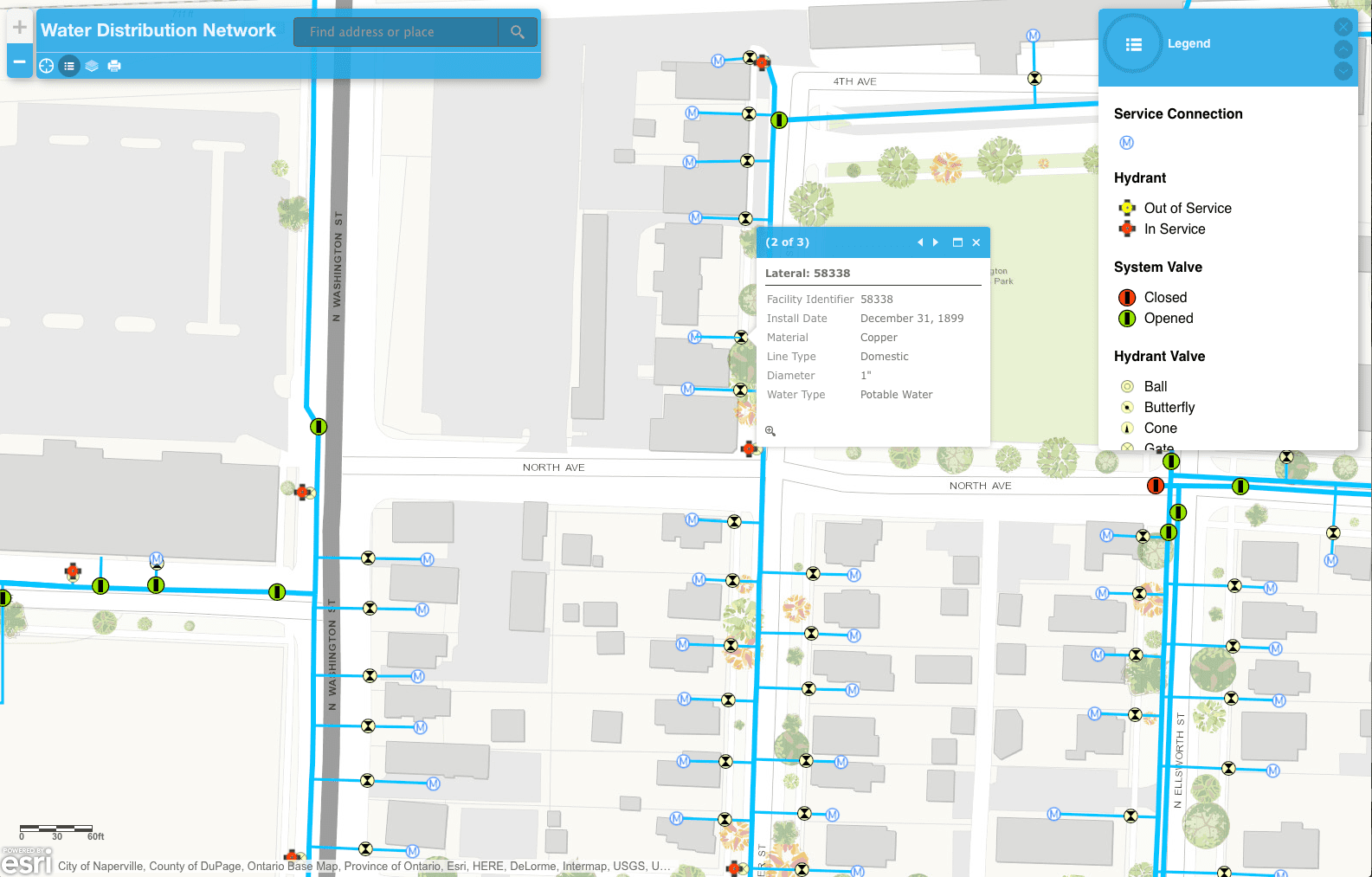
Within the foundational solutions collection, there are several services and maps to get started. These maps and services include a Water Distribution Network map to provide information about water distribution network assets, a Sanitary Sewer Network map with information about separated and combined sanitary sewer network assets, Stormwater Network map, and the Water Asset Locator tool that can be used by staff to search for specific assets in utility maps and applications.
Maintain Utility Assets
To help maintain utility networks, the Water Utility Network Editing map can be used by mapping technicians to maintain thorough water distribution, sewer, and storm water records. The Data Reviewer for Water Utilities helps increase the quality of utility data with a preconfigured set of jobs for performing quality control on water, sewer, and storm water data. The Map Change Request tool can be used by employees to improve utility maps by marking up mapping errors in the office or field. With the Proposed Water Design map, designs can be quickly pass from water engineers and developers for proposed projects throughout your entire organization.
Improve Infrastructure Planning
Within this collection, there are maps and apps used by public works staff to define capital projects, coordinate project schedules, track project performance, and share project status with key stakeholders and citizens. Specifically, the Water Utility Capital Improvement Planning map allows water, sewer, and storm water engineers to rate the condition of infrastructure networks and estimate the cost of Capital Improvement projects.
This is just a small portion of the available maps and apps within ArcGIS Online for Water Utilities. There are many more for responding to emergencies, optimize field operations, improve water conservation, ensure storm water compliance, enhance water loss analysis, generate water reports, CCTV observations, and help you to connect with customers with maintenance activities.
We are having a series of webinars to demo examples of each exciting focus area of ArcGIS Online for Local Government. Our first webinar about Water Utilities is on Wed, Oct 7, 2015 10:00 AM – 10:30 AM MDT. View Recorded Webinar.
As always, if you would like more information or have questions, contact us here.


