Calibration or Static for Base Position
Do you calibrate every project with a rover? Do you really need to? What are the pros and cons?
A site calibration, or localization, is a way to average the error between observed control points and help you know if certain points are outside of your acceptable tolerance. The control is initially established with a defined datum and projection, whether a published coordinate system or a custom local grid. The process of calibrating the site overrides this to adjust your site to fit the control as currently observed. If you don’t input the initial coordinate system, survey field software packages like Siteworks will assume a Transverse Mercator projection.
How can I set up a project with no calibration?
In TBC your project settings have a coordinate system, local site adjustments, Geoids, and a few other things your job may or may not require. If you use the coordinate system as defined in the plans and import your control points, you should be able to immediately check on control throughout the whole job. Publish this project and your rovers and machines will match the control as it was originally established – provided you set up your base station precisely. Instead of calibrating to fit imperfect control points set perhaps years and multiple freeze/thaw cycles before you started the job, you instead are checking control against the coordinate system used by the original surveyor.
Projects in Alaska are increasingly using Low Distortion Projections which help with differences seen between grid and ground coordinates in the older state plane zones. Generally laid out to follow the road system, these are skewed to best center most working areas with the center of the zone – as opposed to the old way of transverse mercator which was split into vertical swaths of the whole state within a particular range of degrees of longitude. FPI has a shared folder with most of the current LDPs in the state, and we add more as we receive them. Simply drag the file into TBC!
What if there is a bust between my calibration, the 3rd party surveyor, and the project owner’s GNSS systems?
If all parties use the coordinate system in the contract documents, specifically the survey control sheet, the discrepancies should be negligible. Issues tend to crop up when different calibrations are performed, or not performed, using different combinations of points with or without underlying projection types defined. Scale factors will likely not match, and comparing multiple tilted-plane calibrations can reveal differing amounts of error throughout the project.
How can I establish a base position without performing a calibration?
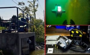
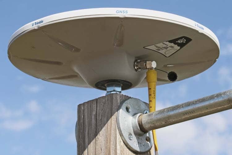
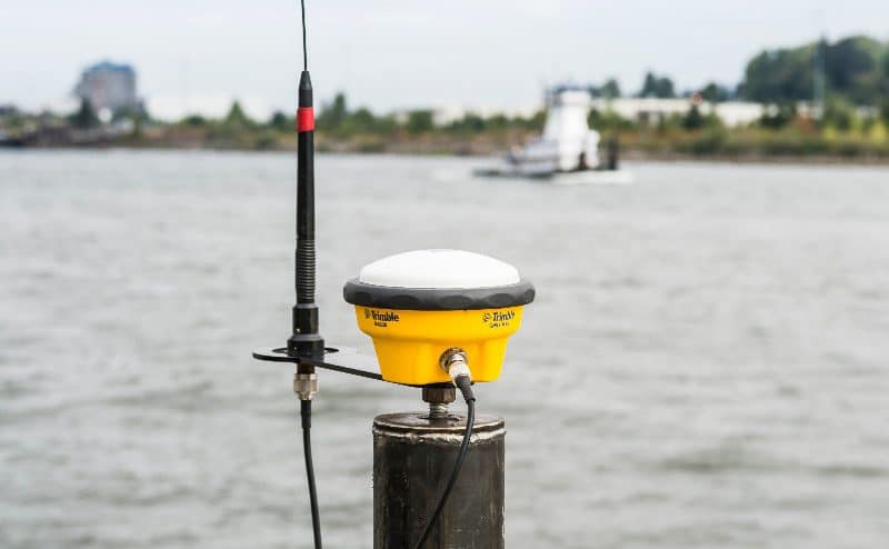
Many grade checkers use the calibration workflow to add an ‘unknown point’ to the control points list. As long as you set up the base in Base Anywhere (or Unknown Point) mode, and perform the calibration in the same work order, Siteworks will prompt you to store it as a control point. This step is not required, however, and a base station coordinate can be established using a straightforward static workflow in the receiver WebUI. Mount your antenna on a solid, fixed mount that ideally can stay in exactly the same spot for the duration of the project. Then log static data on the receiver and post-process the coordinate against CORS stations in the area using Trimble RTX-PP (or OPUS) to dial in your base position in the project datum.
Stay tuned for a more detailed tutorial on this process.
Can I set up a project without a base station?
Yes and No. Trimble supports Real Time Networks, such as ACORN in Alaska, but this is limited by region. Within the network you can receive RTK corrections via an internet connection – cellular, Starlink, etc. You can register for a free account to connect a receiver and see if the precisions are acceptable for your job. Trimble RTX is also improving all the time, and corrections via IP are available globally. A free subscription to this service is included for 1 year with the purchase of any receiver so you can try it out.
What happens if you don’t calibrate and set up on a random control point and start staking?
You would have no way to know if that point is good without checking other control points to verify. If you set up your base on Point 1 and check in on Point 2, the bare minimum, you couldn’t know if both points were a little off in the same direction. If 1 point is .1ft low and the check point is .15ft low, your rover would have you believe the base point is perfect and the 2nd/check point is only off .05ft!
What if you calibrate without a calibrated rod bubble?
With a rod or tribrach out of level you can see an increasing error in the horizontal residuals as you add points to your calibration. This problem would be worse if you are calibrating down a long road project. You could mitigate this by always aiming your antenna Northward resulting in better residuals but a slight horizontal shift of the whole project coincident with the amount of error induced by the bubble. The eBubble in some Trimble receivers is much more precise than a rod bubble,so we recommend it whenever possible.
What should I do if the ground is frozen?
The State of Alaska requires control (especially vertical) be checked after each major freeze/thaw cycle, or environmental event that may change the benchmark elevation – read: earthquakes. Any control established, checked, or calibrated during the winter would have to be rechecked or redone after breakup in the spring. A base position established with a static session would help show, for example, where control has heaved up in frozen ground or sunk in unstable soils.
Keep in mind, if you use a mobile job trailer parked on frozen ground there is a good chance it will also sink. A pole sunk deep into the ground or into permafrost would be the most stable for work year round.
Site Calibration Pros and Cons:
| Pros: | Cons: |
| Familiar(?) | More labor required |
| Needs redone at least once per summer |
| Must find buried control points |
| Averages error gathered from old points |
")