Map More. Move Less. The Latest in Laser Rangefinder Professional Measurement Tools
Whether you are looking to update your current rangefinder equipment or purchase rangefinders for the first time, Frontier can offer advice for streamlining your field data collection processes. Frontier Precision is a long-time reseller of Laser Tech’s reflectorless measurement tools used for standalone measurement of distance, height, elevation, or azimuth or combined with GIS/GNSS system for laser offset mapping. We can help you choose the right mobile app to get results for applications in asset management, forestry and natural resource management, general construction, mining, and utilities and telecommunications.
 The most highly valued benefit of laser mapping is having the ability to occupy a single, convenient, and safe location with the freedom to map as many assets as you can see. When you use your high-accuracy GPS/GNSS device, everything you collect will be based off these precise control points.
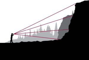
Stay out of harm’s way by remotely measuring or positioning features from a safe location. The power of Laser Tech’s reflectorless technology allows you to acquire measurements to practically any surface type or material, at sharp angles, and from long ranges.
As a GIS professional, you’ve likely made hefty investments in your equipment. By creating a seamless integration to practically any system and workflow.
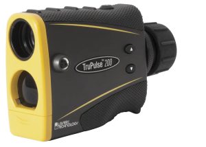
How the TruPulse® Laser Rangefinder Measures Up (TruPulse 200, 200L, 200X or 360/360R): 
- Measures distances, height, missing line and azimuth*
- Calculates Horizontal Distance (HD) + Vertical Distance (VD) + Height (HT) + 2D Missing Line (ML)
- Fits inside a vest pocket and is very economical
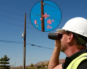
- Displays all measurements and menus right in the scope HUD
- Mounts on a staff or monopod for more stability
- Integrates with GPS and popular GIS software
* Azimuth applies to only the TruPulse 360 model
Learn More:
Frontier LTI TruPulse 101 Presentation
GPS Offsetting Methods Video
TruPulse 200 Series for Construction Applications Video
Tree Height Missing Line Routine Video
Clearance Values for Electric Utilities Video
Featured Mobile Apps for Data Collection:
 LTI MapSmart® on Android Brochure – Android app compatible with Trimble R Series, Catalyst, LTI TruPulse Series
- Collect data with or without GPS, associate points with photos, open or closed traverse, stockpile volume results, report in various formats
- Trimble TerraFlex Mobile App – Android and iOS app compatible with Trimble R Series, Catalyst, LTI TruPulse Series
- GNSS Mapping software with laser rangefinder offsetting capabilities
- Includes “Refine” the position option which will improve accuracy using GNSS positioning.
- Esri ArcGIS® Survey123 (In Beta) – Android and iOS app compatible with Trimble R Series, Catalyst, LTI TruPulse Series
- ArcGIS Online field survey app with laser rangefinder offsetting capabilities
- LTI LaserSoft® Sag Profiler – Android app measuring span, sag and tension
- LTI LaserSoft Conductor Clearance – Android app measuring conductor clearance
- LTI LaserSoft Joint Pole – Android app for joint-use pole audits
- LTI LaserSoft Pole Audit for O-Calc® – Android app designed for users of Osmose’s O-Calc
- LTI LaserSoft Face Profiler – Android app produce blast design MSHA compliant depth and burden reports
Contact us to learn which rangefinder and data collection app is right for your application. We can provide web demonstrations and pricing information.
* All trademarks are registered or recognized trademarks of their respective owners. Trademarks provided under license from Esri.
Related links:
Juniper Systems CT8X2 Android Tablet Data Sheet
Frontier Precision GIS Training, Support, and Services
Trimble TerraFlex Mobile App Data Sheet
Trimble Catalyst DA 2 GNSS Receiver Data Sheet


