UAS/DRONES

PRECISION BEYOND BOUNDS

Frontier Precision Unmanned has the latest innovations in drone aircraft and sensors to fit your job or application. We offer industry-leading products and software from ACSL, Autel, Censys Technologies, DJI, Flybotix, Fotokite, Freefly Systems, Hylio, Inspired Flight, Quantum-Systems, Skyfront, Skydio, WISPR, Vision Aerial, YellowScan, Emesent, AgEagle, Phase One, FLIR, Pix4D, and many others to make sure you get the right product for the right UAS application.

UAS applications include geospatial surveying & mapping, agriculture, construction, energy, forestry, infrastructure, mining, mosquito & vector control, oil & gas, and public safety. 

With LiDAR, your first mapping and survey point should be with us. Our staff has the knowledge and real-world experience to help you implement LiDAR into your business. Just as important, with our range of LiDAR technology, you’ll find a solution that works perfectly with your budget. 

Use the industry’s leading-edge technology without committing long-term capital to technology that may not have a long-term fit. The expert team at Frontier Precision UAS/Imaging Services can help when you have a need for mobile/static scanning or UAS services, but lack the expertise or equipment to meet the requirements of the job. 

Frontier Precision Unmanned offers data-driven professional services for aerial surveying and photogrammetry applications using unmanned aircraft systems. We’re expanding operations to include additional drones, sensors, and platforms to accommodate your data needs. Whether you are interested in operating drones yourself, or sub- contracting a service provider to collect data for a project, Frontier can help you incorporate this exciting technology into your workflow to collect high-precision aerial data. 

TRAINING

You’ll receive hands-on chart study with aeronautical charts, a practice test and review, and lively group discussion.

We’ll cover:

  •  Rules & Regulations
  • Airspace
  • Weather & Weather Sources
  • UAS Loading & Performance
  • Crew Resource Management
  • Airport / Field Operations
  • Radio Communication
  • Emergency Procedures
  • Preflight & Maintenance
applications

We’ll ask you questions to help you make an informed decision on which drone is best for you. What will you be using your drone for — lidar, photogrammetry, infrared? In what kind of conditions will you be flying? And what is your experience level in flying a drone?

solutions

Frontier Precision carries the high-quality, high-versatile drone you need. We are one of the select DJI dealers in the United States. We also carry fixed-wing Delair drones and Microdrones. Along with Pix4D software.

BLUEUASFull Color 1Blue UAS

Need something US-made or off the latest Blue UAS cleared list? 

 Frontier Precision can help provide tailored hardware solutions to meet your specialized needs. 


RELATED UAS PRODUCTS
Visit the Frontier Precision Shop for products related to UAS and more!
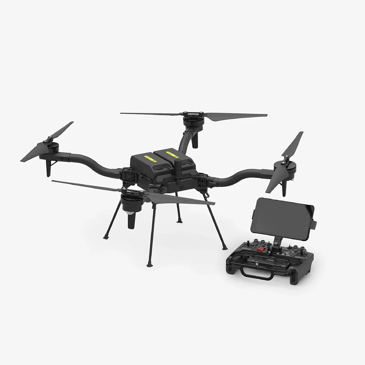
Freefly Astro Max

Freefly Astro Max

Learn More
Quantum-Systems Trinity Pro

Quantum-Systems Trinity Pro

Learn More

Upcoming Training Events

Frontier Precision offers affordable regularly scheduled certified training classes, online eLearning, webinars, as well as custom training options to meet your specific training needs.

UAS Partners

acsl 2

A small NDAA compliant – made in Japan drone, with advanced measures to secure communications, flight data, and photo/video data. 

NDAA COMPLIANT OPTIONS

LEARN MORE

autel

The leader in image quality. The pioneer in drone intelligence.

LEARN MORE

censys

Delivering industry-leading technology and products that will perform and grow business – bringing intelligence from beyond the horizon.

NDAA COMPLIANT OPTIONS
USA MADE

LEARN MORE

dji ag 2

With comprehensive DJI agriculture solutions, operating in broadacre farmlands, orchards, or grasslands, has become a lot simpler.

LEARN MORE

dji enterprise 2

Collect and leverage data with zoom imaging and modular accessories.

LEARN MORE

flybotic

Designed specifically for indoor inspection, the ASIO drone is equipped with advanced sensors and cameras that allow it to navigate and inspect even the most complex environments.

NDAA COMPLIANT OPTIONS

LEARN MORE

fotokite logo b

Fotokite Sigma provides public safety teams with mission-critical situational awareness from elevated perspectives.

NDAA COMPLIANT OPTIONS

LEARN MORE

freefly 1

A rapidly growing commercial and enterprise company representing the intersection of art and technology.

BLUE UAS CLEARED
NDAA COMPLIANT OPTIONS
USA MADE

LEARN MORE

hylio 2

Hylio develops cutting-edge drone technology to deliver the ultimate performance in agricultural crop spraying. Take your farm to the next level with Hylio’s agricultural & crop spraying drones.

NDAA COMPLIANT OPTIONS
USA MADE

LEARN MORE

inspired flight

Perform the most critical missions with Inspired Flight’s USA-made drones.

NDAA COMPLIANT OPTIONS
USA MADE

LEARN MORE

quantum systems

Multi-rotor drone that meets the aerodynamics of an airplane.

NDAA COMPLIANT OPTIONS

LEARN MORE

SkyfrontLogoblackMedium

Skyfront has the longest endurance hybrid gas-electric multicopter drone.

NDAA COMPLIANT OPTIONS
USA MADE

LEARN MORE

skydio 1

Skydio utilizes breakthrough AI to create the world’s most intelligent flying machines for use by consumer, enterprise, and government customers.

BLUE UAS CLEARED
NDAA COMPLIANT OPTIONS
USA MADE

LEARN MORE

wispr logo

WISPR is the most innovative, NDAA compliant American-made drone package ever.

NDAA COMPLIANT OPTIONS
USA MADE

LEARN MORE

vision aerial 2

Vision Aerial Inc. is a drone manufacturer that engineers and builds unmanned systems designed to increase efficiency, reduce industry risks, and save lives.

NDAA COMPLIANT OPTIONS
USA MADE

LEARN MORE

Sensor Partners

emesent vector logo

Through our solutions we automate the collection and analysis of data in challenging GPS-denied environments, delivering revolutionary efficiency, safety, and operational insights to underground mining and other industries. 

LEARN MORE

sentera logo

Sentera is a leading innovator in drone sensor technology, dedicated to providing cutting-edge remote sensing solutions for various industries

LEARN MORE

yellowscan

The YellowScan LiDAR UAV delivers the highest level of accuracy and density for real-time georeferenced point cloud data.

LEARN MORE