Meet the Frontier Team at 2022 Esri UC – Latest GIS Services Offerings
Frontier Precision provides implementation services, training, and technical support to ensure you start down the right path with Esri ArcGIS or to help keep the momentum going with your established GIS initiatives.
For over 30 years, Frontier Precision has been leading the way with specialized field mobility workflows to bring your GIS to the field and back. Our unique capabilities revolve around mobile data collection systems, high accuracy GNSS, laser rangefinders, water monitoring solutions, UAS (Drone) technologies, 3D scanning and mobile imaging services.
Please take time to stop by Booth 708 to talk with our experience staff attending the in-person Esri User Conference in San Diego, July 11 – 14, 2022.
Latest GIS Services From Frontier
 Water utility mapping solutions with ArcGIS Online benefiting any size community.
Implementation and managed services are included so you can get to collecting data as soon as possible.
Click here for more information.
We also have expertise integrating sensor data from Trimble Water / Telelog, Teledyne, SeaFloor Systems, and In-Situ sensors.
This also includes Deep Trekker underwater remotely operated vehicles and robots.
 One-stop shopping with Frontier!
We now provide Esri ArcGIS Online and Trimble and Juniper Systems high accuracy GNSS receiver bundles. We can take your entire order, train you while we implement your system, give ongoing support, renew your licensing, and keep your GIS advancing for years to come!
 Frontier offers implementation and managed services to get started with Esri SaaS for Local Government. This includes a collection of location-based solutions to streamline your process and empowers your staff with location intelligence – perfect for small communities to get started with GIS technology. Put our experienced GIS staff to work allowing you to concentrate on other important responsibilities.
 Ready for the next level asset management or permitting/licensing system? Need a suite of tools for smart water management? Frontier is a Cityworks Implementation partner and Trimble Water integration partner.
Our tailored Jump Starts are the quickest direction to turn when you are looking to create your very first maps and mobile apps.
Budget-friendly Jump Starts are available for ArcGIS Online, Field Maps, Survey123, Story Maps, ArcGIS Dashboards, Trimble TerraFlex, or Juniper Systems Uinta software.
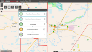
 Contact us for a demo of our FieldSeeker GIS for Mosquito Control or Invasive Species Control software. Both are based on the Esri ArcGIS Online platform and are designed to be the hub for all important data.
The FieldSeeker software suite consists of an office Web app and a cross-platform mobile app with simple, intuitive tools for mapping and reporting data. Information is easily shared, analyzed, and updated throughout the organization.
Frontier also has experienced staff to provide vehicle-mounted spatial imaging services and to help choose the right UAS (drone) solution for your application.
Contact Us
If you cannot attend the Esri UC or are not a current Esri user, please contact us at any time to schedule a one-on-one meeting so we may help you determine the next step in using GIS and geospatial technologies to accomplish more for your organization.
For more information, contact Jacob Wittenberg or Linda Glover at Frontier Precision.


 Water utility mapping solutions with ArcGIS Online benefiting any size community.
  One-stop shopping with Frontier!
 Frontier offers implementation and managed services to get started with Esri SaaS for Local Government. This includes a collection of location-based solutions to streamline your process and empowers your staff with location intelligence – perfect for small communities to get started with GIS technology. Put our experienced GIS staff to work allowing you to concentrate on other important responsibilities.
 Contact us for a demo of our FieldSeeker GIS for

