Oct 19, 2023 | 3D Laser Scanners, 3D Laser Scanning, 3D Laser Scanning Solutions, Automatic Levels, Build Construction, Construction Supplies, Construction Tools, Crash Reconstruction, Crime Scene Investigation, Field Controllers, Forensic Diagramming, Forensics, Forestry & Natural Resources, GIS, Grade Lasers, Handhelds with GNSS, Imaging, Interior Lasers, Land Mobile Hardware, Land Mobile Systems, Laser Levels, Laser Receiver Sensors, Layout Solutions, Mapping GNSS Recievers, Mapping/GIS, Mining, Mobile, Mobile Devices, News & Industry Updates, Rangefinders, Solid Waste, Survey, Survey Field Controllers, Survey GNSS Receivers, Survey GNSS Recievers, Total Stations, Total Stations, UAV Systems, Unmanned Aircraft Systems - UAS, Utilities, Workforce Solutions
Buy or lease the equipment you need now for big savings on your 2023 taxes! The Section 179 tax provision allows businesses to deduct the full purchase price of qualifying equipment bought or financed during the tax year. The Section 179 deduction for 2023 is...

Jun 22, 2023 | Dashboard, ESRI, Esri, Events, Field Maps, Forestry & Natural Resources, GIS, Handhelds with GNSS, Local Government, Mapping GNSS Recievers, Mapping Trimble Field Software, Mapping/GIS, MGIS Field Software, MGIS Office Software, Mobile, Mobile Devices, Mosquito & Vector Control, Solid Waste, UAS Processing Software, UAV Systems, Unmanned Aircraft Systems - UAS, Utilities, Water Resources, Weed Control
For 35 years, Frontier Precision has been leading the way with specialized field mobility workflows to bring your GIS to the field and back. Our unique capabilities revolve around mobile data collection systems, high-accuracy GNSS, laser rangefinders, water monitoring...
Jun 22, 2023 | Dashboard, ESRI, Esri, Field Maps, GIS, Handhelds with GNSS, Local Government, Mapping/GIS, Mobile, Mobile Devices, Utilities, Water Resources
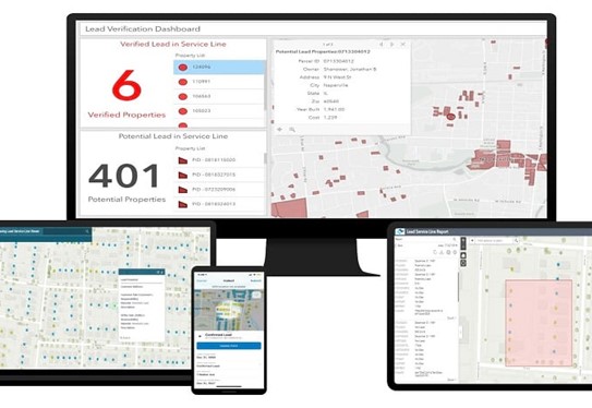
The Environmental Protection Agency (EPA) has released a revision to the Lead and Copper Rule which prioritizes the identification and removal of Lead Service Lines (LSLs) for all utilities. As of October 16, 2024, the Lead and Copper Rule Revision (LCRR) states that...

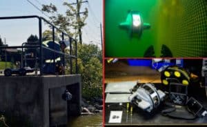
Jan 9, 2023 | 3D Laser Scanners, 3D Laser Scanning, Events, Field Software for Survey, Imaging, Land Mobile Hardware, Land Mobile Software, Land Mobile Systems, Laser Scanning Software, Mapping/GIS, Mining, Office Software for Survey, Professional Services, Survey, Survey Field Controllers, Survey Field Software, Survey GNSS Receivers, Survey GNSS Recievers, Survey Office Software, Total Stations, Total Stations, UAS Processing Software, UAV Systems, Unmanned Aircraft Systems - UAS
Frontier Precision is excited to attend and exhibit at SME MINEXCHANGE – Annual Conference & Expo – February 26 – March 1 at the Colorado Convention Center in Denver, CO! Come see us at Booth #1110. Frontier can provide you with complete Geospatial/Unmanned...
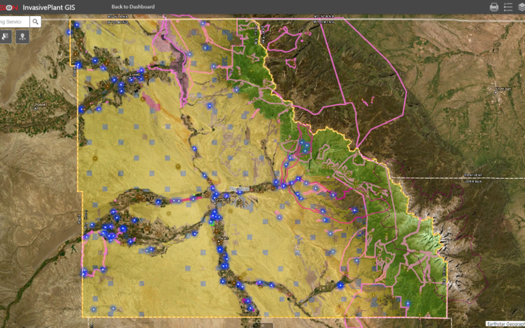
Oct 3, 2022 | Esri, ESRI, Forestry & Natural Resources, GIS, Local Government, Mapping/GIS, Weed Control, Wetland Delineation
FieldSeeker GIS for Invasive Plant Control software is designed to be the hub of all your important operational data. Built on Esri® ArcGIS® Online, it’s a cloud-based system that provides users with simple, intuitive tools for mapping and reporting data related to...
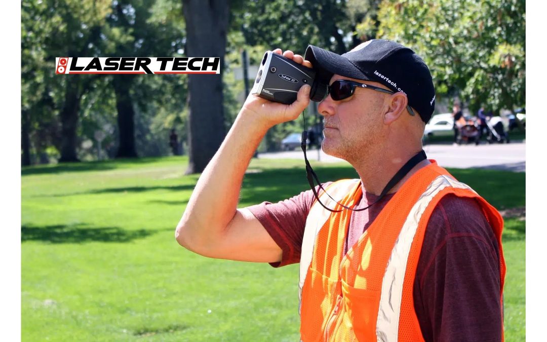
Sep 16, 2022 | Construction Tools, Crime Scene Investigation, ESRI, Fisheries Management and Studies, Forensics, Forestry & Natural Resources, Grade Lasers, Handhelds with GNSS, Interior Lasers, Local Government, Mapping GNSS Recievers, Mapping Trimble Field Software, Mapping/GIS, MGIS Field Software, Mining, Mobile, Mobile Devices, Rangefinders, Utilities, Wetland Delineation
Whether you are looking to update your current rangefinder equipment or purchase rangefinders for the first time, Frontier can offer advice for streamlining your field data collection processes. Frontier Precision is a long-time reseller of Laser Tech’s reflectorless...
")