A recent update from Trimble, announce here, has enabled users to configure map workspaces on Connect to local coordinate systems that can be used for data collection with TerraFlex. Up to this point, the map workspaces and TerraFlex have only supported Lat/Long WGS 1984. Assigning a coordinate system will be done at the map workspace level and all layers in the map will inherit the same coordinate system. You will be guided through the steps of selecting a coordinate system for your map workspace and the coordinate system list will be customized based on your data collection area. The steps below demonstrate how to use a local coordinate systems with a new or existing map workspace.
How to select the coordinate system in a new map workspace on Trimble Connect
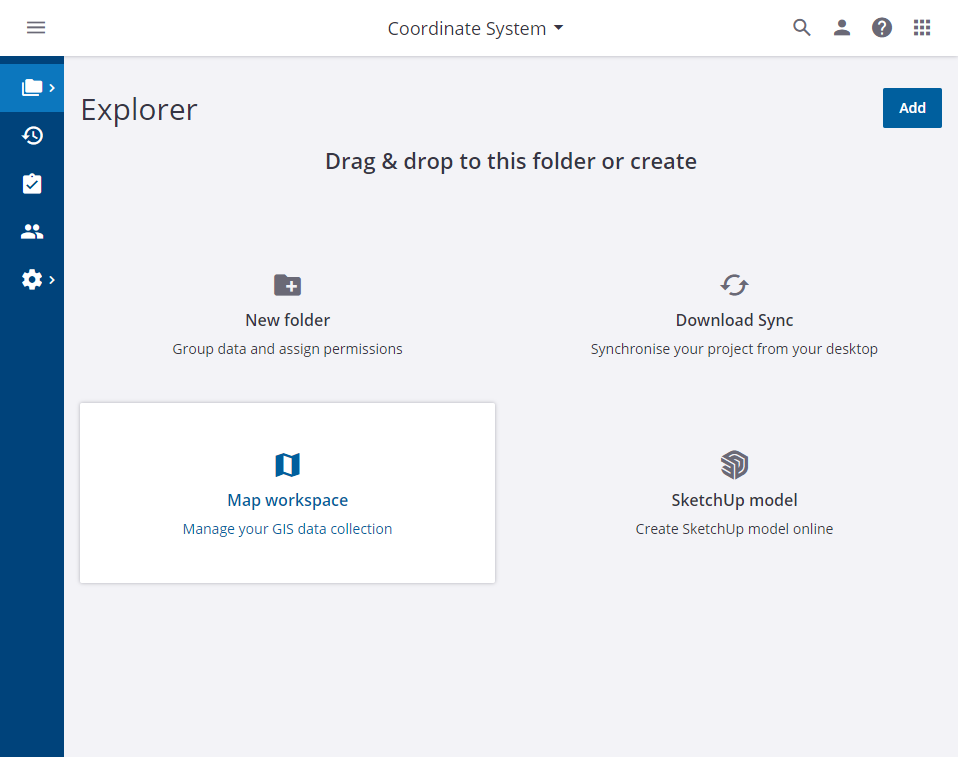
Step 1: Start a new map workspace on Connect.
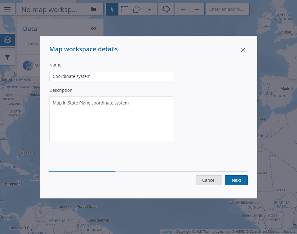
Step 2: Name the map and give it an optional description.
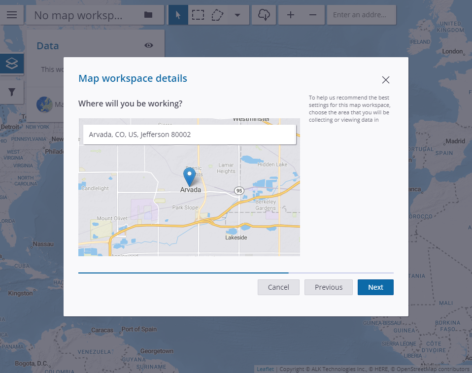
Step 3: Select the area you will be working in. You can type the area name into the search bar or zoom in on the map view.
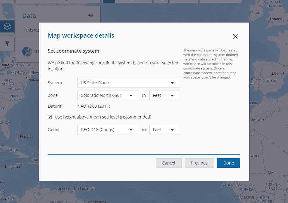
Step 4: Select your system and zone along with unit measurement. For your elevation source, you can choose between mean sea level (MSL) or height above ellipsoid (HAE). Selecting the Use height above mean sea level with give you MSL values and unchecking that box will give you HAE values.

How to duplicate an existing map workspace on Trimble Connect to change the coordinate system
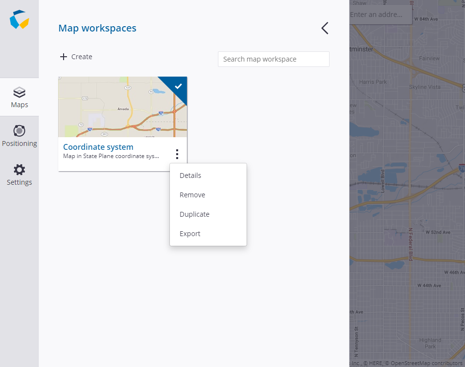
Step 1: Open the map on Connect in the map view.
Step 2: Click the three-line menu button in the map view.

Step 3: On the maps tab, click the three dot menu button on the map you want to duplicate.
Step 4: Choose Duplicate from the list of options.
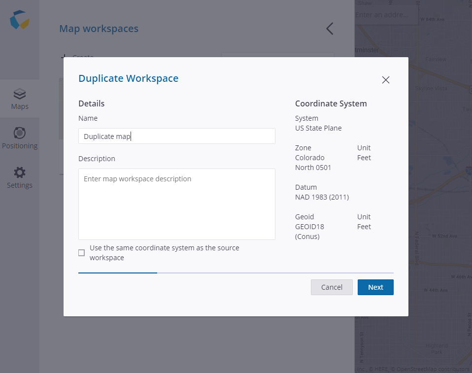
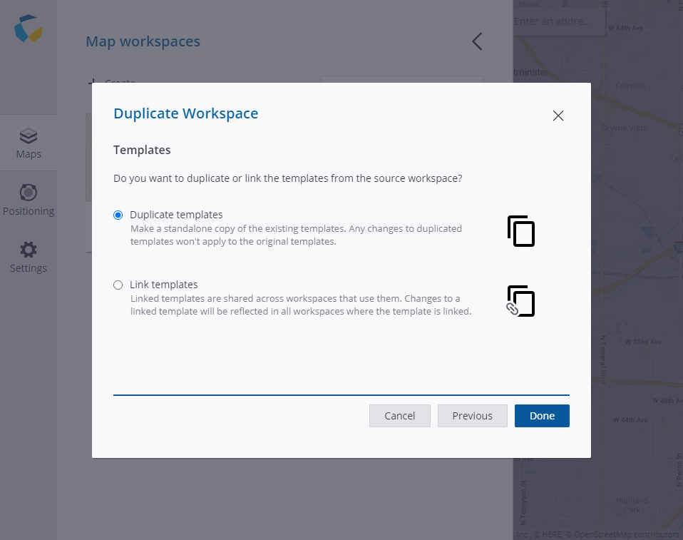
Step 5: Give the duplicated map a name and optional description. Add the bottom of the Duplicate Workspace window, uncheck the box for Use the same coordinate system as the source workspace.
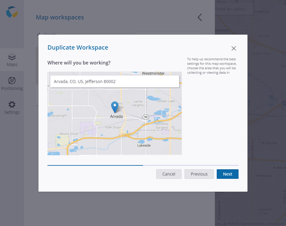
Step 6: Select the area you will be working in. You can type the area name into the search bar or zoom in on the map view.
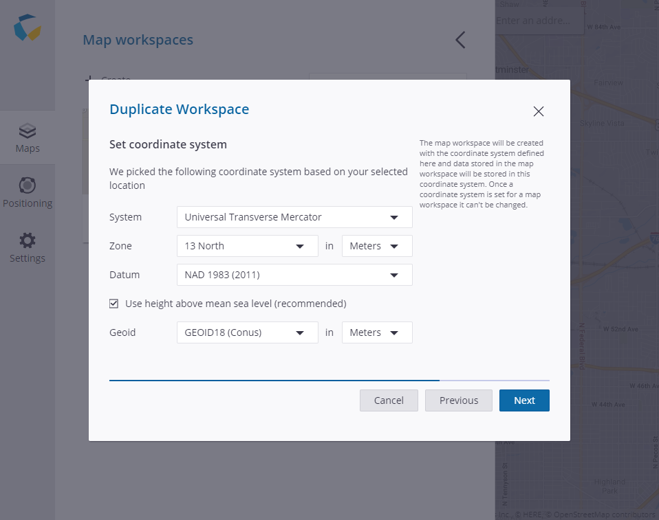
Step 7: Select your system and zone along with unit measurement. For your elevation source, you can choose between mean sea level (MSL) or height above ellipsoid (HAE). Selecting the Use height above mean sea level with give you MSL values and unchecking that box will give you HAE values.
Step 8: You will be given the choice between duplicating and linking the templates. Duplicating will create a copy of the templates that will be separate of any existing map workspace. Linking templates will share the template between your current map workspace and the duplicated map workspace. Any changes to the template will be shared with all linked maps.
Map Workspace Coordinate System FAQs
What coordinate systems are available?
In the Americas, you will have the choice between Lat/Long WGS 1984, State Plane NAD 1983 (2011), and UTM. If you are needing an additional coordinate system, you can request it by contacting your Frontier Precision sales rep or by posting to Trimble Solutions Community.
Can the coordinate systems of an existing maps be changed?
No. However, you can click the menu button while in the map view and choose to duplicate the map to change the coordinate system. This will create a copy of the map workspace with all the templates in a new coordinate system.
Where do I find what coordinate system my map workspace is set to?
In the Map View, click the three-line menu button to access all the map workspaces for the project. Click the three-dot menu for the map workspace and choose Details. The coordinate system information will be displayed on the map workspace details.
Why can’t I link existing layers to my new map workspace that has a local coordinate system?
The layers will need to be in the same coordinate system as the new map workspace in order for them to be linked. You can duplicate your existing map workspace with the desired layers to change their coordinate system and make them available to use in your new map workspace.
What operating systems platforms support the usage of local coordinate systems?
Android, iOS, and Windows will support map workspaces in any of the local coordinate systems offered on Connect. Windows Mobile devices, such as the GeoExplorer series and Junos, will only support maps in Lat/Long WGS 1984.
Will my exported data be in the same coordinate system I set in the map workspace?
Yes. Data exported to csv, shapefiles or file geodatabase will be in the coordinate system set on the map workspace. KML will be exported to Lat/Long WGS 1984 as that is the only coordinate system supported by Google Earth.
I’m not sure about what coordinate system to use. Where can I find more information about coordinate systems?
Trimble did a blog series on coordinate systems that you can find here to inform users about the basics of coordinate systems.
I’m using the Positions or TerraFlex Desktop Add-in for ArcMap. Do I need to change my coordinate system of my map workspace on Connect?
No. Coordinate system management is already built into the Desktop Add-ins so no additional steps are needed. This workflow is only for users that are creating, managing, and exporting content directly on Connect.
Will there be a datum shift if my real-time source is in a different datum?
When configuring your real-time source, you will specify the datum of your real-time source and a datum transformation will be done behind the scenes to align the data if the real-time source is different than the map workspace coordinate system.
Solutions
Frontier Precision provides world-class solutions for a wide variety of industries using leading products, training, technical services and more.


Products
Technical Services
If you require customized technical services and training, please contact Frontier Precision at 800-359-3703 or reach out to a local Frontier Precision location.
Training and Events
Frontier Precision offers affordable regularly scheduled certified training classes, online eLearning, webinars, as well as custom training options to meet your specific training needs.
About Frontier Precision
Contact Frontier Precision
