Sentinel GIS began in 2007 with a handful of early adopters implementing field Larviciding data collection and reporting based on ArcPad and ArcMap. Within a short time, we added Adulticiding, then continued the modular approach with Surveillance and Service Request coming next. We learned a great deal during those early years from all our customers, working closely with field supervisors and field staff to make changes and add features based on user feedback. One of the things we’ve always enjoyed the most and been the proudest of is working with and listening to our customers.
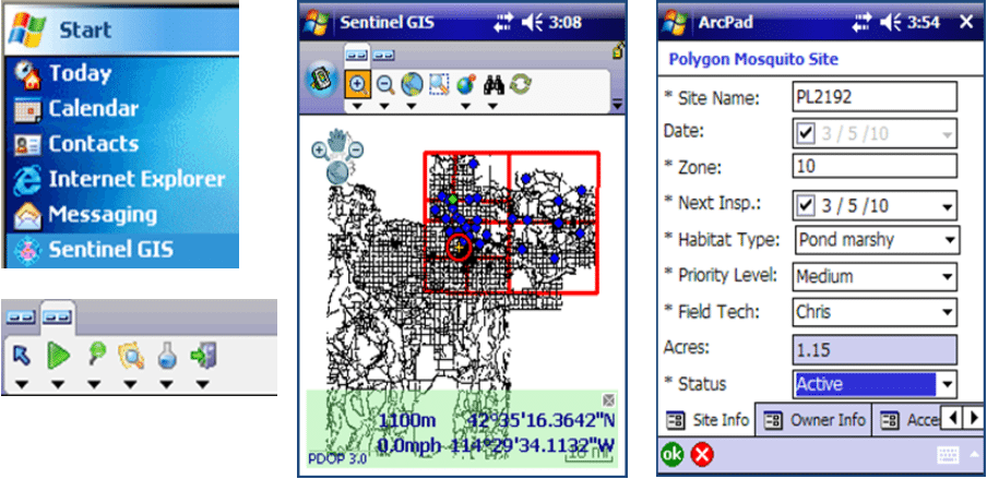
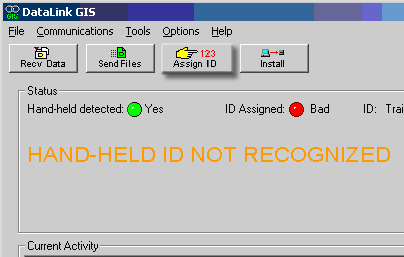
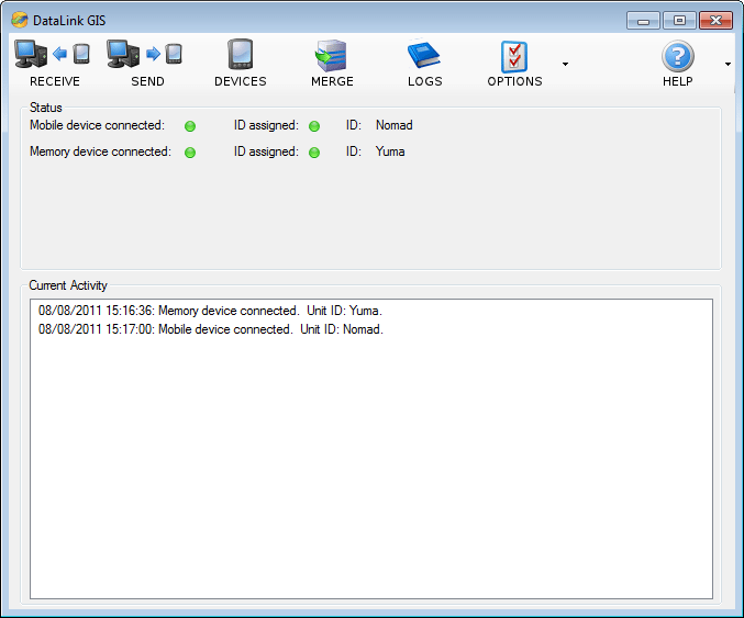
In those early years, mobile devices from Trimble and Juniper Systems were a mainstay of field data collection, with a range of mobile devices that represented the industry-leading best of the best. Windows Mobile devices were still widely used, along with some rugged Windows tablets. Cabling up a mobile device to download data that had been collected during the day or after a night spray mission was the de facto standard. Automating the process for downloading and processing data was seen as a huge gain in efficiency from previously available methods of collecting field data. ArcPad-based field collection was also a de facto standard for mobile GIS.
Fast-forward 10+ years to 2018, and many mosquito control operations are using one or more of our Sentinel modules. Most of them are small to medium size operations, with between 1-20 field staff. Sentinel has many pros, such as its modular nature, allowing customers to pick and choose workflows based on operations, or implement one workflow at a time based on budget or time and resources. Other pros include leveraging professional GIS tools with a simplified GIS interface, easy reporting, and low IT overhead. Most of our customers have limited GIS or IT support, and they’ve been able to do very well with Sentinel GIS. Many users with no previous GIS experience can now add Desktop and Mobile GIS to their list of professional skills because of things they’ve learned with Sentinel GIS.

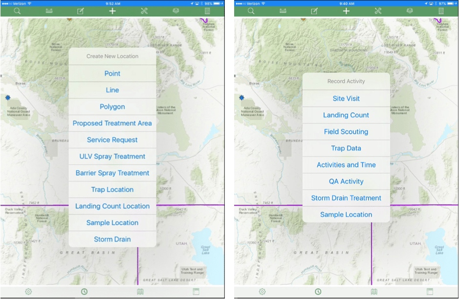
Over the years, our customers have requested many things that have been challenging or impossible to deliver using ArcMap and ArcPad and disconnected editing with data sync. People have asked if we can run Sentinel on an Android tablet or an iPad, or if they can get service requests immediately in the field, or even something as simple as auto-rotating the map in the field for their ULV spray drivers, or changing the symbology for mosquito sites, or changing the size of the data entry form in ArcPad – none of which are possible with Sentinel.
Additionally, some of the things that started out as pros have become bottlenecks or cons, such as being limited to devices that support ArcPad (Windows and Windows Mobile devices), syncing data and merging it, and even data entry in ArcPad period. ArcPad has had a long and storied life, but it doesn’t take a genius to realize that it is a little long in the tooth. Esri has announced that it will enter mature support in September 2018 and will be retired on July 1, 2019. That means that no software updates or patches will be available for ArcPad after August 2018, and technical support will no longer be available for ArcPad after July 1, 2019.
About 9 years ago we also began developing FieldSeeker GIS, which was built on ArcGIS Server and targeted enterprise customers. In 2015 we introduced the FieldSeeker Mobile for iOS Mobile application, which was accompanied by the FieldSeeker Web office application. Enterprise services-based applications such as FieldSeeker have some inherent advantages, such as real-time connectivity and data update across the enterprise, Web-based tools (no software installation on the local computer), and no dependence on ArcMap or ArcPad. But at least initially FieldSeeker had the limitation of only making financial sense to large operations, because the ArcGIS Server licenses required initially for the system were higher priced. Over the years, and especially with the introduction of the Native iOS app, requirements have relaxed and changed and prices have dropped to the point that FieldSeeker server bundles make sense for much smaller operations, including those with 5-10 field staff.

Since late 2017, we have been hard at work on a couple of large projects intended to close the gap between Sentinel GIS and FieldSeeker GIS and provide one path forward for operations of all sizes. One of those projects is the Cross-Platform Mobile Application (CPMA), which targets iOS, Android, and Windows 10. This mobile app will provide support for all major device types, professional and consumer. App installation and updates will be provided through the Apple Store, Google Play Store, and Windows Store.
The 2nd large project is a new FieldSeeker Office application suite that is based on the Esri JavaScript API. This Web app suite will include a dashboard landing page, targeted workflows for different user roles, improved analytics, an entirely new layout, and no reliance on browser plugins such as Silverlight. Both the CPMA and FieldSeeker Office are built around Esri Web maps and ArcGIS Online. It will be possible to fully host the system including data and services. The Esri platform requirements are such that even very small operations of 1-5 field staff will be able to benefit.
All of that is a long introduction to the main point: Sentinel GIS also will be entering Mature Support in September 2018 like ArcPad. However, we will provide support through December 2019 rather than ending in the middle of a field season. Sentinel GIS will be retired on December 31, 2019. Because so many customers are using Sentinel GIS currently, we are very sensitive to customer needs, so if support needs to be extended past December 31, 2019, we will be open to that as well. We know it takes time to budget and plan for updates.
In the meantime, the recommended path forward for Sentinel customers will be Windows ULV as an upgrade to Sentinel Adulticiding, and FieldSeeker GIS as an upgrade to Sentinel Larviciding (with Storm Drain app), Surveillance, and Service Request.
Windows ULV was release early in 2017 as a path forward for DataMaster, FieldSeeker Mobile ULV, and Sentinel Adulticiding. Here’s the blog that talks more about the Windows ULV software, and also this What’s New blog. In the context of this discussion, the main point is that the reliance on ArcPad has been removed. In fact, the new Windows ULV Office and Mobile software don’t require any GIS licensing. They operate as a simple self-contained system, with import and export options for shapefiles and KMZ files, and soon, the ability to sync data to an ArcGIS feature service. We feel this “middle ground” approach of being GIS-friendly and Esri-compatible, but also standalone and consumer friendly (KMZ) will make training and software use easier for all operations, whether you have the Esri platform or not.
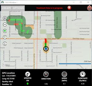
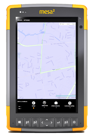
Many of our customers have already purchased Juniper Mesa 2 Windows 10 tablets for Sentinel Adulticiding. The good news is, the new Windows ULV software is also targeted for the same field device, so the hardware you already have will work without any changes. Upgrading to the new system is as simple as installing and configuring the new software. Now through December 2019, we are offering a significant discount off licensing costs for Sentinel Adulticiding customers that wish to upgrade to Windows ULV. It’s licensed per office user and mobile device – contact us for details. The cost of software upgrades and maintenance is offset by not having to pay ArcPad maintenance or other platform costs.
For Sentinel Larviciding, Surveillance, and Service Request customers, FieldSeeker GIS “core” includes all the functionality of these three modules. FieldSeeker Mobile is available today for iPhone and iPad, and later in 2018 it will be available for Android and Windows 10. That means if you replace older Windows Mobile devices, such as the Trimble Juno 3B, Juno 5, Nomad, or the Juniper Archer, Archer 2, or Mesa with the new Juniper Mesa 2 Windows 10 tablet, you’ll be able to use it with Sentinel now, and the new Windows ULV or FieldSeeker Cross-Platform Mobile Application if and when you upgrade to those. Upgrading to FieldSeeker includes purchasing software licenses, deploying the applications, and migrating your Sentinel data into FieldSeeker (which we will do for free). Software licenses are based on the number of concurrent users in the office, and the number of field devices. Currently, data, services, ArcGIS Server, and the Web application can be deployed on a hosted Amazon EC2 server for you, or it can be deployed on in-house IT resources. Later in 2018 when the cross-platform mobile application is available, you can also choose to deploy data and services in ArcGIS Online in which case you will not need a server at all.

FieldSeeker will have some immediate advantages for current Sentinel customers, including:
- It includes all 3 modules that you used to have to purchase separately with Sentinel: Larviciding, Surveillance, and Service Request, all integrated into one app (and later in 2018 Storm Drain app)
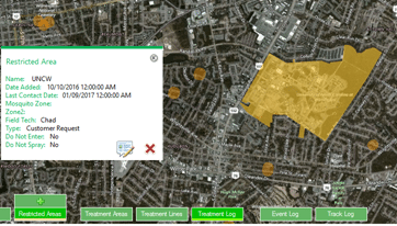
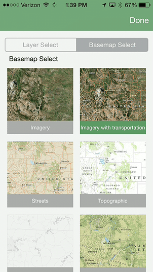
- It includes many features that were not available in Sentinel, including On-Truck Inventory, Proposed Treatment Areas, Restricted Areas, miscellaneous activities, picture attachments, navigation directions, Esri basemaps, and more
- Everything is real-time, so all data that is entered is immediately available to the entire operation – no data transfer, no sync, no merge
- Offline data collection is also supported
- No limitation on number of concurrent editors
- Office software is Web-based, so nothing to install on office computers
- Access the system from any computer using a Web browser
- Mobile app is built for phones and tablets, so workflows are familiar and intuitive
- No ArcPad licenses or maintenance
Because FieldSeeker is Web and services-based, more is required than with Sentinel, where all you needed was a desktop and a USB cable or a memory device connection or maybe Wi-Fi for transferring data. But the benefits justify the investment, because the FieldSeeker System and the ArcGIS platform can be used more easily by more people in the organization. An ArcGIS Server license is currently required, but the requirements are much lower than they used to be. A Standard Workgroup license, which works with SQL Express (free), can handle the data needs and typical load of 10-20 users without any problem. We can help with Amazon hosting if you don’t have in-house IT resources or a physical or virtual server to put it on. And, later in 2018, FieldSeeker services and data can be fully hosted in ArcGIS Online so it won’t matter if you have 5 users or 50 or 500, you won’t have to worry about the server. So that’s our plan in a nutshell:
So that’s our plan in a nutshell:
- Continue to provide support for Sentinel GIS through at least December 31, 2019. Please tell us if you need support longer than that.
- Provide a path forward for mobile software that does not rely on ArcPad and that will run on a variety of modern device types via the Cross-Platform Mobile Application (FieldSeeker CPMA) and the Windows ULV solution.
- Provide corresponding Office tools via ULV Office and FieldSeeker Office Web-based office suite for configuration, reporting, service requests, lab entry, editing, review, and analytics.
- Help customers update, upgrade, and migrate their existing data.
- Continue to communicate our plans and help to answer questions.
Please contact us for software demos, trials, and quotes, as well as with questions, concerns, or suggestions.
Sales related needs: Linda Glover
Technical needs: Chad Minteer
Solutions
Frontier Precision provides world-class solutions for a wide variety of industries using leading products, training, technical services and more.


Products
Technical Services
If you require customized technical services and training, please contact Frontier Precision at 800-359-3703 or reach out to a local Frontier Precision location.
Training and Events
Frontier Precision offers affordable regularly scheduled certified training classes, online eLearning, webinars, as well as custom training options to meet your specific training needs.
About Frontier Precision
Contact Frontier Precision
