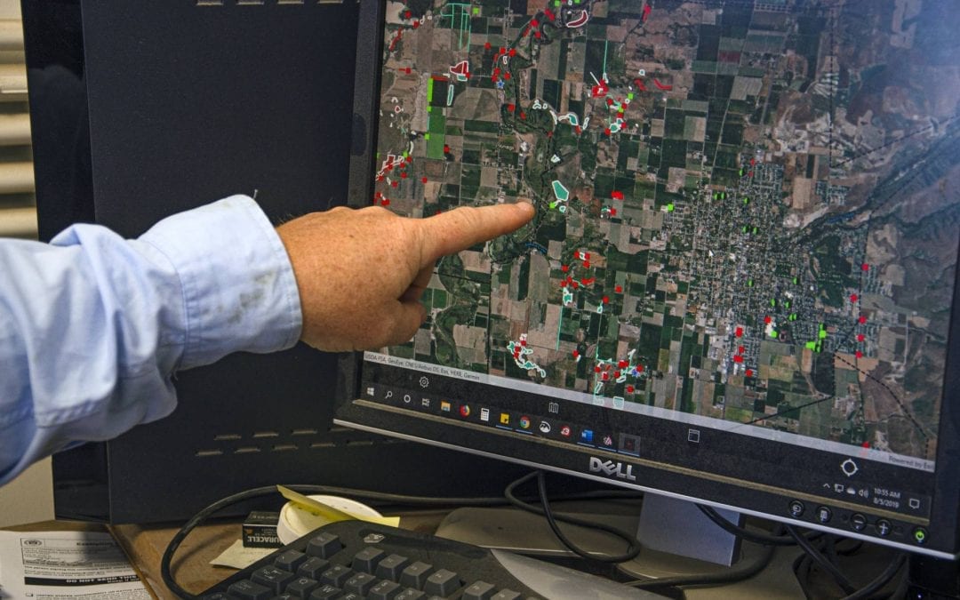
Our Fall 2019 release of FieldSeeker Office includes many improvements suggested by customers, including map editing tools for managing larviciding field sites, new reports and updates to existing reports, and quality improvements especially in Lab Tools. We appreciate all your feedback! As more customers have years of field data to review and manage, having specific editing tools that match the workflows related to site management rather than just the basic Web GIS editing tools becomes more and more important. We are confident that the following toolset is a good start based on many conversations with customers.
Editing Tools
We’ve added several awesome things to the Editing experience to assist you with creating, managing, editing, and cleaning up site data. You’ll find these new tools on the bottom toolbar of the Edit widget in any of the Map workflows (Review, Service Request, Map).
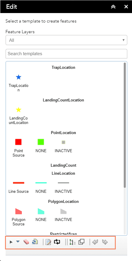
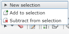
- New Selection / Add To Selection / Remove From Selection. Used in conjunction with the Merge Features tool (#7).
- Clear Selection.
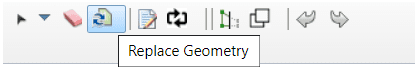
- Replace Geometry. Used for line or polygon features to redraw the feature geometry while keeping all the attributes and history.
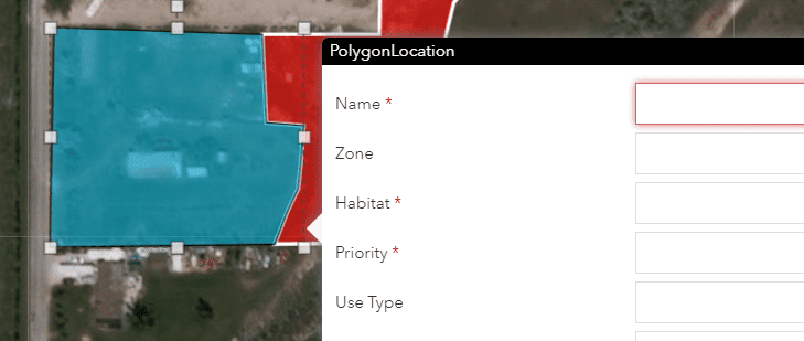
- Opens the attribute editor popup.
- Converts a point, line, or polygon location to another feature type while keeping all the attributes and history; for example, convert point feature to polygon feature.
- Cut or extend a line or polygon feature.
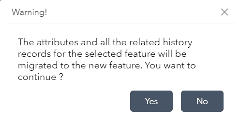
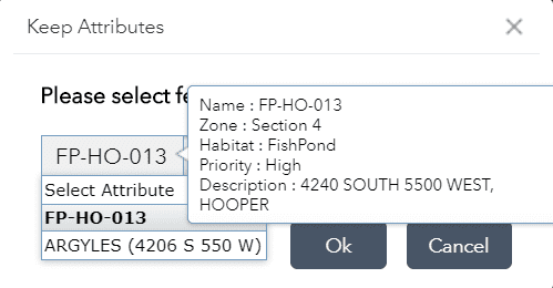
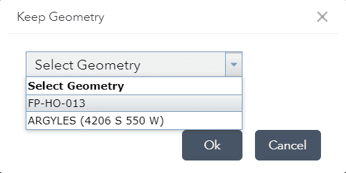
- Merge Features. Merge selected features into a single feature while keeping all the attributes and history.
- Undo.
- Redo.
Replace Geometry
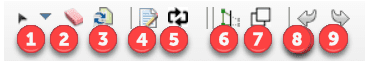
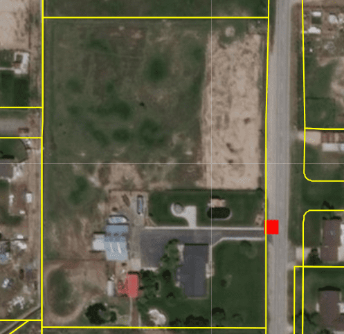
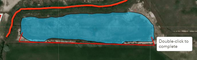
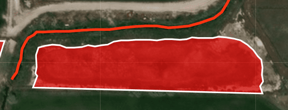
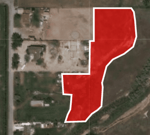
The Replace Geometry tool lets you redraw the shape of a feature while keeping the attributes and history. Anyone who has tried to edit the shape of a polygon that has lots of vertices knows what a challenge that can be. Maybe the site was originally created with streaming GPS and it has lots of zigs and zags, or it crosses itself. Maybe the site was originally imported from shapefiles and it includes multi-part features. Or maybe the site was originally sketched in and just has the wrong shape. Whatever the case, editing the shape of the site using standard editing tools can be challenging.
A GPS’d polygon location with lots of vertices

A self-intersecting polygon
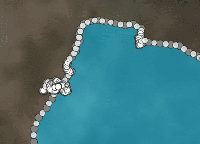
Good luck with standard Web geometry editing tools
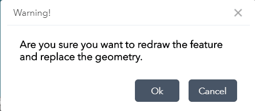
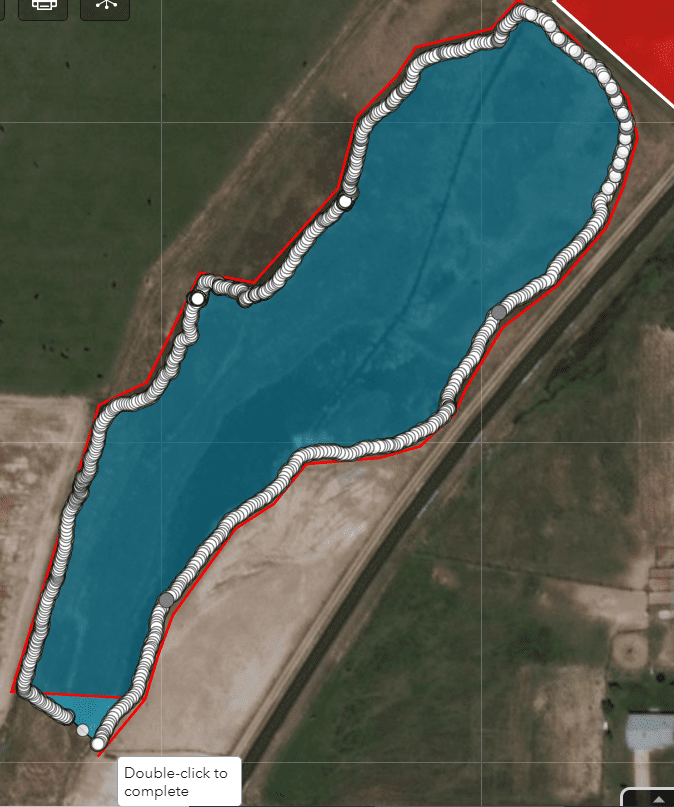
The Replace Geometry tool was designed to help make editing the shape of a site much easier by allowing you to simply replace the shape by drawing a new one. To use the tool, tap a line or polygon location, click Replace Geometry, redraw the feature, and double-click when finished. The editing status bar will show that the feature is being saved. If the results aren’t what you wanted, click Undo and try it again.
![]()
Convert
The Convert tool lets you change a selected location type to a different type and keep all the site details and history. For example, you can convert a point location to a line or polygon, or convert a line location to a polygon, or convert a polygon to a point. This is useful if sites have been created by geocoding addresses or by importing from a system that only supports points and you really want lines or polygons, or if the field tech selected the wrong site type (such as line instead of polygon) and they’ve entered inspection and treatment data for it already.
To use the tool, tap a point, line, or polygon location, click Convert, select the type of feature to draw, and double-click when finished. The editing status bar will show that the feature is being saved. If the results aren’t what you wanted, click Undo and try it again.
![]()


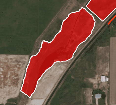
Merge Features
The Merge Features tool lets you select multiple features and combine them into a single feature, keep the attributes you want, and combine all the history. This is useful if multiple small polygons were created when one larger location would work better, or if geocoding created duplicate points, or if the field tech inadvertently created new or duplicate locations or storm drains instead of using an existing one.
To use the tool, select New Selection and select more than one location to merge. You can modify the selection using the Add To, Remove From, and Clear. Click Merge Features. Select which feature’s attributes to keep and whether to keep the geometry from one of the features or redraw it. When complete, you will see the single remaining feature with the combined history.

![]()


Additional Less-Known Tools
The Reshape (which extends or trims lines and polygons), Auto-Complete, and alternative polygon construction tools have been there, but are lesser known. These can be very helpful for specific situations.
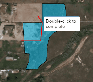
For example, if you’d like to straighten out the boundary of a polygon location, you can use the Reshape tool to extend the polygon. To use the tool, select the polygon, click Reshape, then draw the boundary to extend the polygon to, starting and ending inside the existing polygon.

![]()
Reshape can also be used to trim a line or polygon, for example if construction has reduced the size of a location. To trim, select the location, click Reshape, then draw the trim line across the feature, starting and ending outside of it.
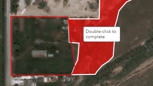
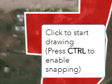
Auto-Complete lets you draw a polygon next to an existing one so that there is no gap or overlap. Start and finish your polygon boundary line inside an existing polygon.
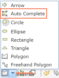
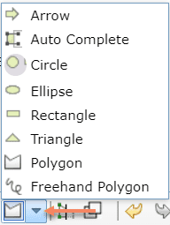
Polygon Construction Tools include Arrow, Circle, Ellipse, Rectangle, Triangle and Freehand in addition to the normal Polygon and Auto Complete.
Snap can be enabled while using any editing tools by pressing and holding the Ctrl key on your keyboard while drawing in the feature geometry. A cross symbol will display when you hover over a vertex on an existing feature.
Reports
Reports never seem all that exciting, but we all know that getting data back out of any data system is one of the main reasons for using it. So we pay close attention to customer requests for improvements to existing reports or needs for custom reports and try to incorporate these into our standard FieldSeeker product.
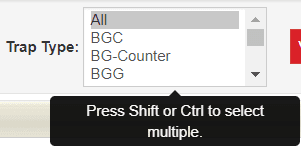
All reports have been improved by making report parameters multi-select (previously, it was one or all). This provides better flexibility when running a report for specific conditions.
Several reports have had specific improvements based on customer feedback. For example, the Mosquito Disease Detail report now correctly shows the results of all pool testing including negative results, not just disease positives. Other reports have had data issues sorted, errors resolved, or layout improvements.
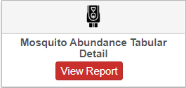
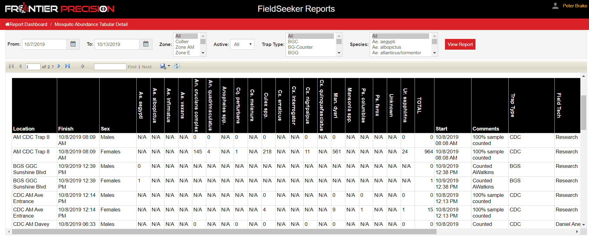
We’ve also added some new reports, including the Mosquito Abundance Tabular Detail report, which shows species counts in a more compact and readable format for export and analysis.
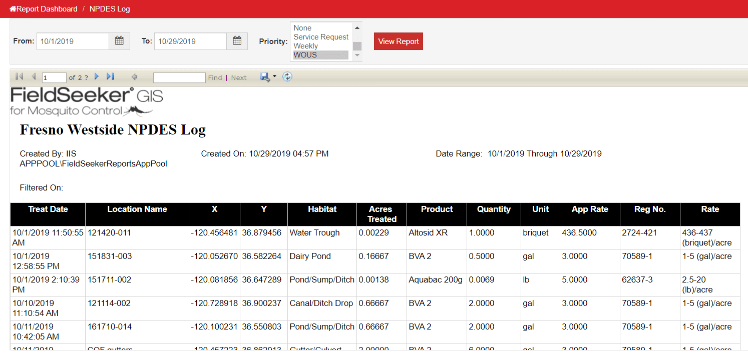
We also added a custom NPDES Log report which shows treatments on Waters of the US, which is important in California.
Conclusion
Current work in progress with FieldSeeker Office includes Gateway integration, improved data review tools, and aerial data import workflows. These will be discussed in other blog articles coming soon.
Questions?
As always, if you have any questions or would like more information about FieldSeeker, please don’t hesitate to reach out to us. Linda Glover, our Mosquito GIS Sales Manager, is always happy to answer sales-related questions. Chad Minteer, our FieldSeeker Product Manager, is always happy to get feedback and enhancement ideas.
Solutions
Frontier Precision provides world-class solutions for a wide variety of industries using leading products, training, technical services and more.


Products
Technical Services
If you require customized technical services and training, please contact Frontier Precision at 800-359-3703 or reach out to a local Frontier Precision location.
Training and Events
Frontier Precision offers affordable regularly scheduled certified training classes, online eLearning, webinars, as well as custom training options to meet your specific training needs.
About Frontier Precision
Contact Frontier Precision
