Feb 14, 2020 | 3D Laser Scanners, Laser Scanning Software
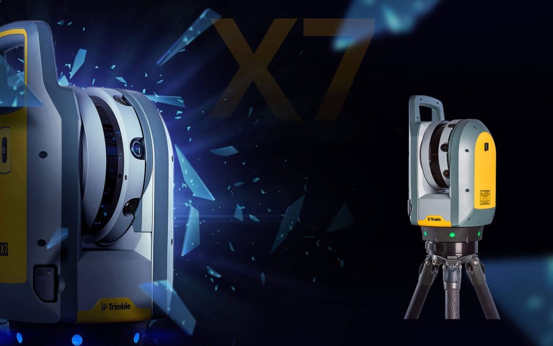
Today we took the Trimble X7 outside to scan in cold weather and test the high-sensitivity mode on some black cars parked in the parking lot. Check out the video below to see how it performed. In total today, we did 23 scans, two of them in high sensitivity, full...
Feb 6, 2020 | 3D Laser Scanners, Land Mobile Hardware, Land Mobile Software, Laser Scanning Software, Survey Office Software
In this video we demonstrate how to cut “slices” along a linear path to extract road features from a point cloud. This is a useful tool when trying to define features along a roadway, such as curb and gutter. In this particular example, we show how to cut...
Feb 3, 2020 | Survey Field Controllers, Survey Field Software, Survey GNSS Recievers, Total Stations
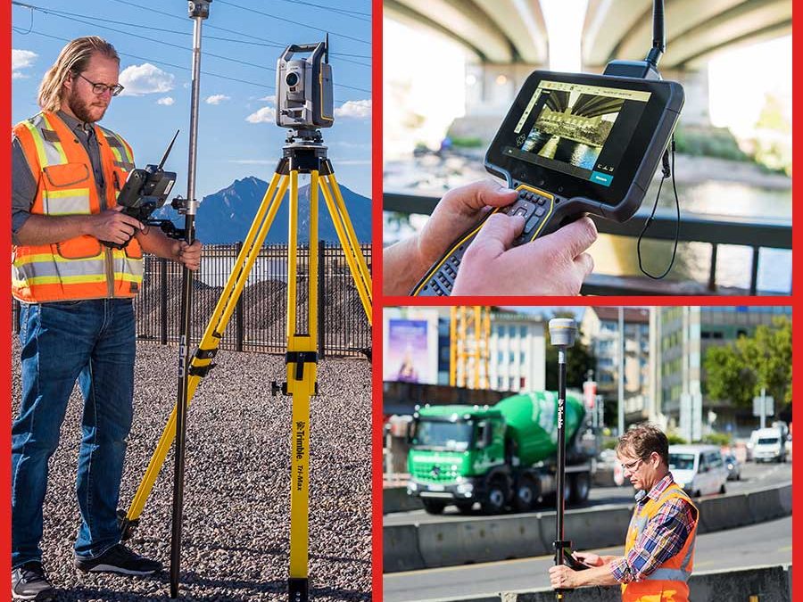
In this video we demonstrate how to stake to a reference alignment. This will allow you to see your current position’s station and offset on an alignment, relative to a referenced road. When doing this, Trimble Access will record the design and reference alignment...
Jan 24, 2020 | Survey Field Controllers, Survey Field Software, Survey GNSS Recievers, Survey Office Software
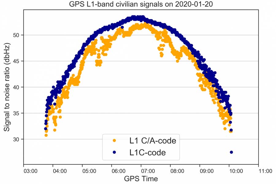
A new GPS civilian signal is now available for use. The new signal is stronger, more accurate, more resilient to interference events, and is inter-operable with the European Galileo system. This is made possible by the first GPS III becoming operational. The new...
Jan 20, 2020 | Environmental Monitoring, Ground Water Monitoring, Storm Water Monitoring, Surface Water Monitoring, Water Level Monitoring, Water Quality Monitoring, Water Resources
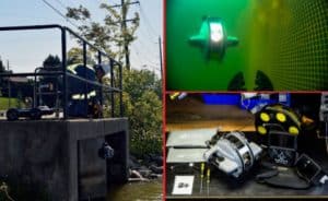
The new VuLink cellular/satellite transmitter from In-Situ makes remote monitoring easier and more reliable than ever before. VuLink is optimized to work with In-Situ brand water quality and water level instruments with “one-touch setup” and can also be interfaced...
Nov 26, 2019 | Larviciding, Mosquito & Vector Control, Mosquito and Vector Control, Service Requests, Surveillance & Disease Distribution
Our November 2019 release of the FieldSeeker cross-platform mobile app (CPMA) is the biggest update yet! Many of the changes are “under the hood” to make the app more maintainable, more responsive, and easier to enhance. Since first developing the app and releasing...
Nov 26, 2019 | Mosquito & Vector Control, Mosquito and Vector Control, ULV/Adulticiding, Uncategorized
We love releasing updates that include customer enhancement requests. Our v1.8 release includes a significant expansion to the warning information system that provides the flexibility to warn and inform your drivers of pretty much anything based on proximity to...

Nov 20, 2019 | 3D Laser Scanners, 3D Laser Scanning, 3D Laser Scanning Solutions, Automatic Levels, Build Construction, Construction Supplies, Construction Tools, Crash Reconstruction, Crime Scene Investigation, Esri, Estimating Software, Field Controllers, Field Software for Survey, Forensic Diagramming, Forensics, Forestry & Natural Resources, GIS, Grade Lasers, Handhelds with GNSS, Imaging, Interior Lasers, Land Mobile Hardware, Land Mobile Software, Land Mobile Systems, Laser Levels, Laser Receiver Sensors, Laser Scanning Software, Layout Solutions, Mapping GNSS Recievers, Mapping Trimble Field Software, Mapping Trimble Office Software, Mapping/GIS, MGIS Field Software, MGIS Office Software, Mining, Mobile, Mobile Devices, Modeling Software, Mosquito and Vector Control, Office Software for Survey, Project Control Software, Rangefinders, Solid Waste, Survey, Survey Field Controllers, Survey Field Software, Survey GNSS Receivers, Survey GNSS Recievers, Survey Office Software, Total Stations, Total Stations, UAS Processing Software, UAV Systems, Unmanned Aircraft Systems - UAS, Utilities, Water Resources, Workforce Solutions
Buy or lease the equipment you need now for big savings on your 2019 taxes! The Section 179 tax provision allows businesses to deduct the full cost of qualifying equipment and software purchased or leased by the end of the year.Most small and medium-sized businesses...
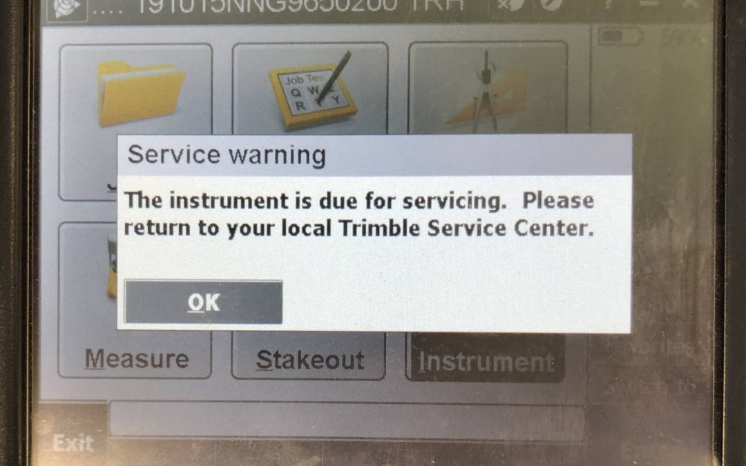
Nov 18, 2019 | Survey Field Controllers, Total Stations
Have you seen the message indicating that your total station is due for servicing? A lot of times we are asked what this message means, and what should be done when this message appears. This message will come up as a reminder for your S-Series instrument after 3000...
Nov 6, 2019 | Larviciding, Mosquito & Vector Control, Mosquito and Vector Control, Service Requests, Surveillance & Disease Distribution
Our Fall 2019 release of FieldSeeker Office includes many improvements suggested by customers, including map editing tools for managing larviciding field sites, new reports and updates to existing reports, and quality improvements especially in Lab Tools. We...
")