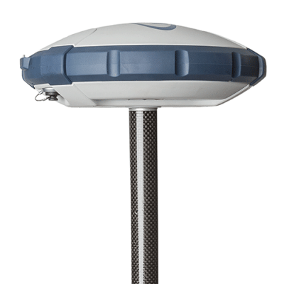
Description
Each Trimble® Business Center (TBC) Edition is designed to support a set of related workflows:
- Viewer (Unlicensed): Import + review field data, view projects, + export to Trimble field devices + software.
- Field Data Edition: Export third-party field data, perform basic CAD functions, complete data quality control, + work with level data.
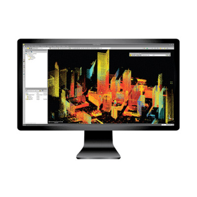
- Surface Modeling Edition: Basic point cloud management, create + edit surfaces + alignments, cut/fill maps, + earthwork reports.
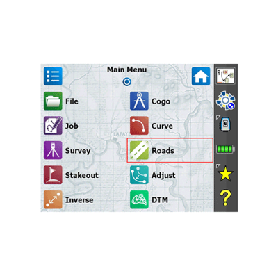
- Survey Intermediate Edition: GNSS post-processing, network + traverse adjustments, site calibrations; work with background images, labels, + dimensions.
- Survey Advanced Edition: Work with Trimble Vision™ data, create plan sets, process cadastral data, leverage full COGO + corridor routines.
- Site Modeling Edition: Convert + elevate 2D geometry into 3D for field operations; cleanup project data.
- Site Construction Edition: Compute site mass haul + site takeoff computations, linear quantities, layer depths, + material volumes.
- Infrastructure Construction Edition: Parametric intersection, interchange, + ramp designs with corridor mass haul quantities + volumes.
Each Trimble® Business Center (TBC) Module is designed to support a group of workflows around a single topic. The modules are add-ons to an edition.
- Aerial Photogrammetry Module: Process + create deliverables with Trimble + third-party UAS data in TBC + UASMaster.
- ANZ Toolbox: Use a variety of commands that support 12d Model and Australian Asset Design and As Constructed (ADAC) workflows.
- Drilling Piling Dynamic Compaction Module: Create drill plans + reports for Trimble DPS900™ Machine Control Systems.
- GIS Module: Seamlessly integrate GIS data from Trimble Access™ + TerraSync™ software into TBC + connect to external GIS databases.
- Mobile Mapping Module: Process, register, + manage MX9 Mobile Mapping data; work with MX hardware calibrations.
- MM MX9 Laser Correction Module: Account + adjust for multiple-time around (MTA) laser effects in the MX9 Mobile Mapping hardware.
- Monitoring Module: Define movement alarms, visualize displacements in 3D, and create monitoring reports from any survey data.
- Scanning Module: Register + colorize SX10™ + X7™ data; classify regions, extract features, + create deliverables from SX10™, X7™, + 3rd party point clouds.
- Tunneling Module: Create + edit tunnel models for Trimble Access™ Tunnels + create customized as-built + geometry reports.
- Utility Modeling Module: Generate + visualize gravity, pressurized, + other utility runs in parametrical constrained trenches.
It’s time to put software licensing on your terms.
With the new subscription-based licensing plans for Trimble Business Center software, we’re putting you at the center of it all. With lower upfront costs, access to more capabilities, the latest software updates, and visibility into usage, scale your license with your needs.
Subscription choice
Offerings positioned to suit your workflows. Upgrades available to expand as you need.
Latest Releases
Your license is always current so you can utilize the latest enhancements and updates.
Flexible Terms
Buy annually, then upgrade, add seats or opt out at any time.
Online License Management
Assign users and generate usage reports to optimize your licenses.
Trimble ID-Based
Each TBC user has their own Trimble ID, each Trimble ID has its own TBC seat.
Cloud Hosting
Take your TBC license wherever you go – online or offline – no need to connect to a license server or plug in a dongle.
Solutions
Frontier Precision provides world-class solutions for a wide variety of industries using leading products, training, technical services and more.
Products
Frontier Precision knows that every measurement its customers take is important. It’s why Frontier Precision not only offers the latest, cutting-edge measurement tools, but also understand the continuing need for service and support — because How You Measure Matters encompasses the total customer experience.
● Used & Clearance Equipment
● Rental Equipment
● Drones/UAS Aircraft
● Underwater ROV’s & Robots
● Survey
● Mapping & GIS
● Damage Prevention & Locating Devices
● Mosquito & Vector Control Software
● Invasive Plant Control Software
● Monitoring
● Scanning/Imaging
● Construction
● Augmented Reality
● Mixed Reality
● Forensics
● Water Resources
● Software
Technical Services
From Geospatial Services to GIS Professional Services to Water Resources Data Acquisition Services, Frontier Precision delivers leading-edge measurement technology. We’ve been there, every centimeter of the way, as geospatial technology has evolved. No matter what your need for accurate measurement, we have the experience and expertise to create a customized solution for you.
● Water Resources Data Acquisition Services
If you require customized technical services and training, please contact Frontier Precision at 800-359-3703 or reach out to a local Frontier Precision location.
Training and Events
From Geospatial Services to GIS Professional Services to Water Resources Data Acquisition Services, Frontier Precision delivers leading-edge measurement technology. We’ve been there, every centimeter of the way, as geospatial technology has evolved. No matter what your need for accurate measurement, we have the experience and expertise to create a customized solution for you.
- Technical Training & Events Calendar
- Technology Webinars
- Customized Training Request
- On-Demand Training
- Learning Lab
Frontier Precision offers affordable regularly scheduled certified training classes, online eLearning, webinars, as well as custom training options to meet your specific training needs.
Support
Frontier Precision provides world-class support from centers across a wide section of the western United States. Need support for any geospatial products, software or services?
Contact Frontier Precision at 800-359-3703.
About Frontier Precision
Frontier Precision’s measure of excellence can be traced back to 1988. Four years later, in 1991, Frontier Precision partnered with Trimble — a United States-based GPS equipment manufacturer at the time, and the rest is history. Since then, Frontier Precision has grown with Trimble to be one their largest and best geospatial distributors in the world.
We’ve been at the frontier of technology for three decades, continually offering customers new tools and solutions, all with our end goal in mind to help make our customers efficient, productive, and profitable with today’s and tomorrow’s technology. Frontier Precision is an employee-owned company — each of our team members is committed to your success.
Contact Frontier Precision
WHEREVER YOU ARE, WE ARE.
From our original office in Bismarck, North Dakota, we’ve grown our footprint thousands of miles in every direction.Today, you’ll also find us in South Dakota, Minnesota, Colorado, Alaska, Montana, Idaho, Hawaii, Wyoming, Oregon and Washington — delivering the Frontier Precision difference to more people each day.