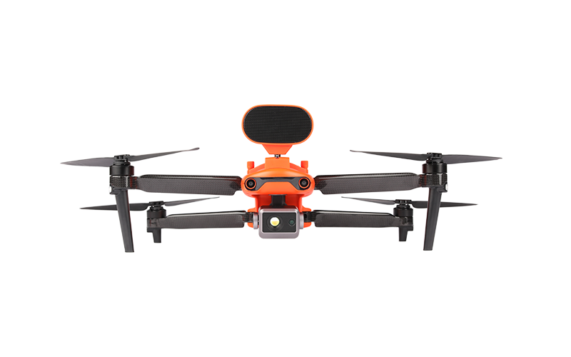
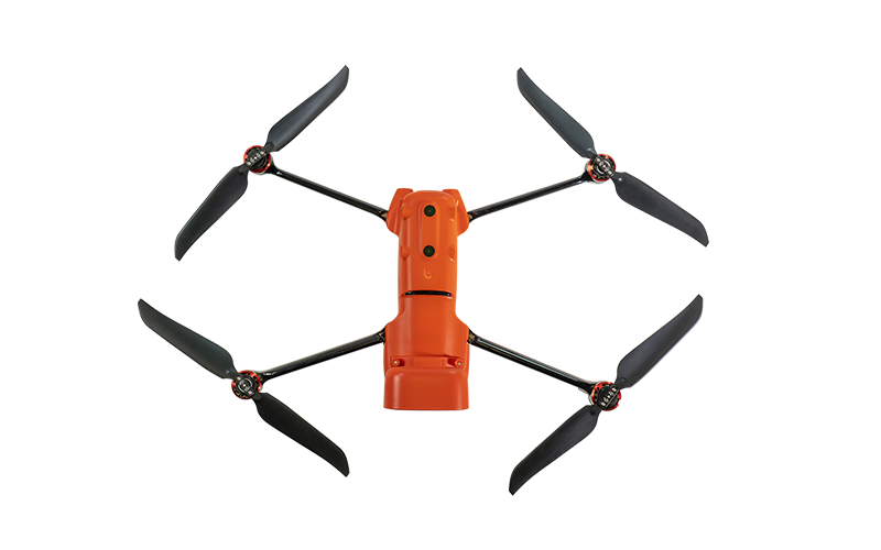
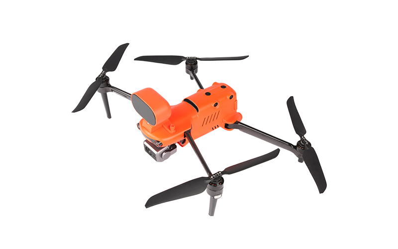
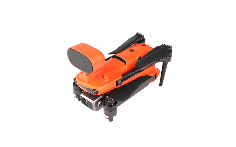
Description
640 x 512 25Hz New Thermal Imaging Sensor
Equipped with a 640 x 512 high-resolution thermal imaging camera featuring a 13mm focal length lens and a 16x digital zoom, it is easier than ever to observe distant targets. The system uses a new image processing algorithm, making thermal details clearer and more discernible than other options with similar resolution and hardware.
Multiple Temperature Measurement Modes
• Central Temperature Measurement: view real-time display of the temperature in the center area of the screen
• Spot Temperature Measurement: tap the screen and the temperature of the selected object will be displayed in real time
• Regional Temperature Measurement: get a dynamic view of the average, maximum, and minimum temperature displayed in a selected area
• Temperature Alarm: monitors the screen temperature in real time. The system prompts the user when the temperature reaches a set threshold.
• Isotherm: set a temperature range and the system will detect any objects within the temperature range specified
• Image Enhancements: supports real-time adjustment of image brightness, contrast, and image details. The system will highlight any objects within the temperature target.
• 10 Thermal Color Palettes: White Hot, Cold and Hot, Rainbow, Enhanced Rainbow, Iron Bow, Lava, Artic, Searing, Gradation, Heat Detection
• Powerful Infrared Thermal Analysis Tool: IRPC TOOL: This free temperature measurement tool is developed specifically for the 650T, and enables the users to quickly import images, edit and analyze temperature measurements, and generate detailed reports for sharing and collaboration.
• Picture-in-picture: visual and thermal imagery are combined to help users quickly interpret data and aid in critical decision making.
50MP Ultra-sensitive Camera
The EVO II Dual 640T V3’s RYYB sensor features the Moonlight Algorithm 2.0 that provides excellent noise reduction in limited lighting conditions, further enhancing its 50 megapixel camera to give users more detail for better forensics and analysis.
.8-inch Sensor Size
The EVO II Dual 640T V3’s .8-inch RYYB CMOS offers up to 144% ~ 233% more surface area when compared to 1/2-inch or 1/2.3-inch competitors for maximum details in high-contrast lighting conditions.
RYYB Sensor Technology
RYYB sensor technology moves away from RBG cameras by offering up to 40% more light sensitivity in low-light scenarios.
PDAF+CDAF Autofocus System
Never lose sights of your subjects with a combination of PDAF (Phase Detection Auto Focus) and CDAF (Contrast Detection Auto Focus) technology for fast and accurate tracking.
Get the Full Scene
The system supports 16x digital zoom and 4x lossless zoom, providing long-distance image acquisition and detailed insight into scenes safely.
4K HDR for Greater Dynamic Range
4K HDR automatically balances overexposure and underexposure when shooting scenes with too much contrast, producing clearer images with more layers.
SkyLink 2.0 Video Transmission
SkyLink 2.0 is built into the EVO II V3 chipset, expanding the possibilities for your most critical workflows.
• 9+ Miles | Do more because you can fly further
• QHD | Incredible video resolution within a mile, meeting most common use cases
• 2.4GHz / 5.8GHz / 900MHz | Supports tri-band communication with automatic frequency hopping for maximum anti-interference capabilities (900MHz is only applicable for FCC countries).
360° Obstacle Avoidance
Equipped with 19 groups of sensors – 12 visual sensors, the main camera, ultrasound, IMUs, and other sensors – enables the building of 3D maps and path planning in real time.
Practical and Convenient
• Deploy Rapidly: deploy in under a minute. It can go from its case to in the air in 45 seconds
• No Fly Zones*: does not have any no fly zones and will not prevent the pilot from taking off
• No Forced Updates**: does not need to be on the latest hardware or app version in order to take off unlike other competitors
• Non-ITAR: more export freedoms as it is not under the US’s International Traffic in Arms Regulations.
*Please fly safely and consult your local laws and regulations. Autel Robotics and Frontier Precision is not liable for any unauthorized flights.
**It’s required to update the latest firmware and app to enjoy comprehensive warranty. More information please refer to warranty policy.
Industry-leading Performance
• Maximum Flight Time: 38 minutes
• Maximum Transmission Range: 9.3 miles (15km)
• Maximum Wind Resistance: 27mph (12m/s)
• Maximum Flight Speed: 45mph (20m/s)
• Maximum Lift Capability: 2lbs (920g)
Autel Smart Controller V3
The Smart Controller V3’s 7.9-inch, 2000nit high-brightness screen is clearly visible even under direct sunlight. SkyLink 2.0 Transmission technology guarantees long-distance operations up to 9 miles away and enhances anti-interference abilities with tri-band frequency hopping. The customized Android system allows for additional flexibility a with 3rd party apps and an IP43 rating ensures all-weather performance.
• 7.9-inch HD Touch Screen
• -4° to 104°F Temperature Range
• 2000 nits Maximum Brightness
• IP43 Resistance
Broadcast with Live Deck 2
Transmit real-time HD video to a wide variety of devices, allowing cross departmental teams enhanced situational awareness and communication, which can lead to quicker and better decision making.
• 1080P / 60 FPS Video Stream
• Three Auto-switch Bands
• 7.5 Miles Transmission Range
• IP43 Resistance
Applications:
• Line Inspections: reduce costs, increase safety, and improve inspection workflow
• Firefighting: locate hotspots, provide overwatch, and shorten response times
• Security: perform overwatch, conduct forensics, accident reconstruction, and crowd monitoring
• Search and Rescue: identify subjects, reduce response times, and optimize search area with mission planning
• Chemical: inspect plants more efficiently while improving work safety and lowering costs
• Solar: streamline the inspection process, discover defects or faulty hardware using the thermal payload
Solutions
Frontier Precision provides world-class solutions for a wide variety of industries using leading products, training, technical services and more.
Products
Frontier Precision knows that every measurement its customers take is important. It’s why Frontier Precision not only offers the latest, cutting-edge measurement tools, but also understand the continuing need for service and support — because How You Measure Matters encompasses the total customer experience.
● Used & Clearance Equipment
● Rental Equipment
● Drones/UAS Aircraft
● Underwater ROV’s & Robots
● Survey
● Mapping & GIS
● Damage Prevention & Locating Devices
● Mosquito & Vector Control Software
● Invasive Plant Control Software
● Monitoring
● Scanning/Imaging
● Construction
● Augmented Reality
● Mixed Reality
● Forensics
● Water Resources
● Software
Technical Services
From Geospatial Services to GIS Professional Services to Water Resources Data Acquisition Services, Frontier Precision delivers leading-edge measurement technology. We’ve been there, every centimeter of the way, as geospatial technology has evolved. No matter what your need for accurate measurement, we have the experience and expertise to create a customized solution for you.
● Water Resources Data Acquisition Services
If you require customized technical services and training, please contact Frontier Precision at 800-359-3703 or reach out to a local Frontier Precision location.
Training and Events
From Geospatial Services to GIS Professional Services to Water Resources Data Acquisition Services, Frontier Precision delivers leading-edge measurement technology. We’ve been there, every centimeter of the way, as geospatial technology has evolved. No matter what your need for accurate measurement, we have the experience and expertise to create a customized solution for you.
- Technical Training & Events Calendar
- Technology Webinars
- Customized Training Request
- On-Demand Training
- Learning Lab
Frontier Precision offers affordable regularly scheduled certified training classes, online eLearning, webinars, as well as custom training options to meet your specific training needs.
Support
Frontier Precision provides world-class support from centers across a wide section of the western United States. Need support for any geospatial products, software or services?
Contact Frontier Precision at 800-359-3703.
About Frontier Precision
Frontier Precision’s measure of excellence can be traced back to 1988. Four years later, in 1991, Frontier Precision partnered with Trimble — a United States-based GPS equipment manufacturer at the time, and the rest is history. Since then, Frontier Precision has grown with Trimble to be one their largest and best geospatial distributors in the world.
We’ve been at the frontier of technology for three decades, continually offering customers new tools and solutions, all with our end goal in mind to help make our customers efficient, productive, and profitable with today’s and tomorrow’s technology. Frontier Precision is an employee-owned company — each of our team members is committed to your success.
Contact Frontier Precision
WHEREVER YOU ARE, WE ARE.
From our original office in Bismarck, North Dakota, we’ve grown our footprint thousands of miles in every direction.Today, you’ll also find us in South Dakota, Minnesota, Colorado, Alaska, Montana, Idaho, Hawaii, Wyoming, Oregon and Washington — delivering the Frontier Precision difference to more people each day.